Alejandro de Humboldt National Park
Also known as Parque Nacional Alejandro de Humboldt, Alexander von Humboldt National Park
Eastern Cuba's mountain rainforest, where toxic rock bred hundreds of plants found nowhere else.
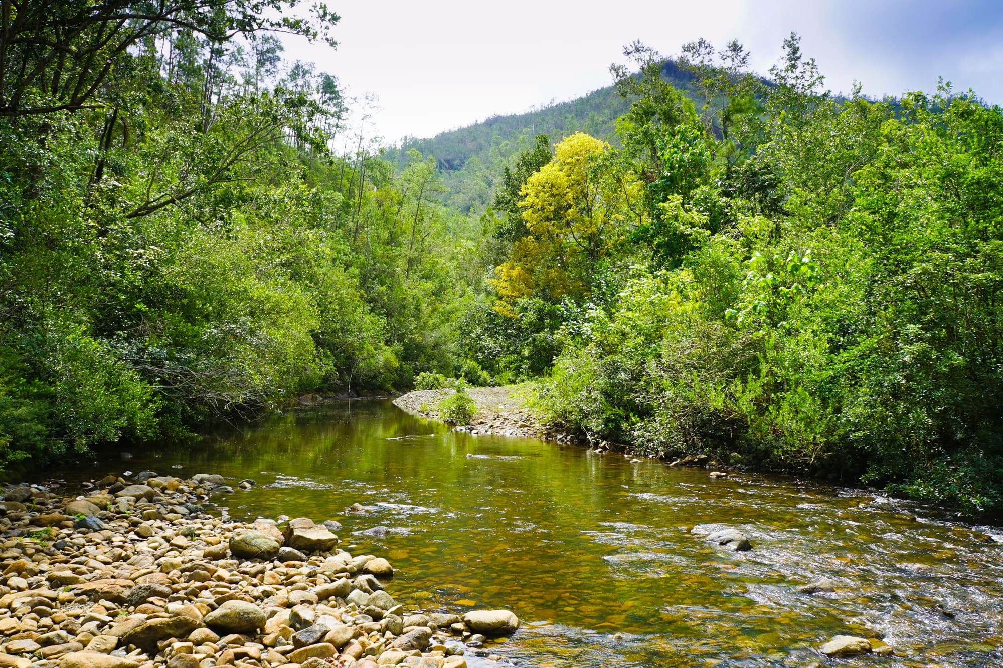
01
Introduction
A mountain range whose soils poison most plants, and the unusual things that grew anyway
Alejandro de Humboldt National Park covers about 710 square kilometres of the Sagua-Baracoa mountains in the far east of Cuba, shared between the provinces of Guantánamo and Holguín. It climbs from a coast of mangroves, bays and coral to peaks of roughly 1,170 metres, with lowland rainforest, pine woods and cloud forest in between.
The unusual part is the rock. Much of the park sits on serpentine and peridotite, rock pushed up from the Earth's mantle that is short of nutrients and toxic to most plants. The few that coped adapted, and then split into new species. Cuba's nomination file counts 905 endemic plant species here (species found only in Cuba), and 343 of those grow nowhere outside the park. It rains a lot, and the whole arrangement depends on it.
People are part of the picture, in small numbers. The IUCN counts 11 settlements with about 5,450 residents inside the boundary, and the coastal valleys were planted with coconut and cacao through most of the last century. Visits are usually arranged from Baracoa, the old coastal town on the Atlantic side, where the road from the mountains meets the sea.
02
How it formed
Mantle rock, millions of years of shelter and a few decades of formal protection
The story starts underground. The park lies on an island-arc structure built up between the Oligocene and the Quaternary, with a base of ocean crust (ophiolite, in the geologists' word) that was thrust up from the Earth's mantle at a subduction zone. Parts of the serpentine and peridotite massifs have stood exposed for more than 40 million years, which makes them among the oldest in the Caribbean, according to Cuba's nomination file. The same rocks are rich in nickel, a detail that matters later in this story.
Over that time the land was planed and weathered into long, high plateaus, with thick crusts of weathered rock on top. One block did something odd. The limestone mass of the Farallones de Moa sits like an island among the serpentines, and its Great Cavern is one of five natural sites in Cuba officially regarded as national monuments. Elsewhere the park has what is called pseudokarst: sinkholes, closed basins and caves, normally a limestone habit, formed in rock that isn't limestone.
The region also had good luck. The nomination file says the climate here was little disturbed by the glaciations of the Quaternary, so the mountains served as a refuge for Caribbean plants and animals, and the Committee's inscription text puts that refuge role in the Miocene to Pleistocene. Add the toxic soils and the huge swings in rainfall, and the result is a slow machine for making new species. Parts of the park have never had a plant collected from them, the nomination file admits, so the species lists are still incomplete.
People left a light mark. Only one pre-Columbian archaeological site is known, at Aguas Verdes on the coast. In the 18th and 19th centuries some peripheral places in the mountains were used as palenques, shelter sites of people who had escaped slavery. In the early and middle 20th century the coastal valleys were planted with coconut and cacao, and around La Melba underground chromium mining created a small town. Farms on the Toa and Jaguaní riverbanks in the 1940s and 1950s were abandoned by the end of the decade because the access was poor and the crops weak. In the 1960s and 1970s the pine woods of Ojito de Agua were logged, until protection ended it in the mid-1980s.
Protection came in steps. The Jaguaní and Cupeyal del Norte natural reserves were set up in 1963, and the whole area became part of the Cuchillas del Toa Biosphere Reserve in 1987, a UNESCO designation whose core area was recorded as 89,741 hectares, larger than the park that later grew inside it. In 1986 Cuban biologists Giraldo Alayón and Alberto Estrada reported ivory-billed woodpeckers at Ojito de Agua, and the woodpecker specialists Lester Short and Jennifer Horne confirmed the sighting weeks later, according to Audubon magazine. Ornithologist Martjan Lammertink then spent eight months at the site across 1991 and 1993 and found no sign of the birds. In 1996 the reserves were united as a single national park, named for the German naturalist Alexander von Humboldt.
The World Heritage Committee inscribed the park on 16 December 2001. At that point the nomination still described parts of the terrestrial and marine area as awaiting approval, and the Committee asked Cuba to finish its management plan within 12 months. A plan for 2009 to 2013 followed, and a later one for 2021 to 2025.
Trouble has come from outside the boundary as much as inside. Between 2000 and 2006 the state granted or confirmed eight nickel-mining concessions around the park, hurricanes such as Ike in 2008 and Matthew in 2016 flattened stretches of forest, and illegal gold mining has taken hold since 2013. Those threats are taken up under Challenges.
03
Timeline
From uplifted ocean crust to a protected park, with a few hard knocks since
Serpentine and peridotite massifs rise from the oceanic crust and stay exposed
The mountains shelter Caribbean plants and animals through the glacial periods
Peripheral places in the mountains serve as shelters for people escaping slavery
Coastal valleys are planted with coconut and cacao; La Melba grows around chromium mining
Farms along the Toa and Jaguaní rivers are cleared, then abandoned for poor access
The Jaguaní and Cupeyal del Norte natural reserves are established
Cuban biologists report ivory-billed woodpeckers at Ojito de Agua
The Cuchillas del Toa Biosphere Reserve is designated around the future park
The separate reserves are united as Alejandro de Humboldt National Park
Inscribed on the World Heritage List on 16 December
Hurricane Matthew damages about 12 per cent of the park
A fire at Ojito de Agua burns about 1,896 hectares
04
Why visit
A mountain-to-sea transect where small animals and strange plants do the heavy lifting
Start with the small things, because the park's records are mostly small. Cuba's nomination file says the park is home to three of the smallest vertebrate species in the world, and the UNEP-WCMC datasheet names them: a bat of two or three grams, the bee hummingbird at 63 millimetres and a frog of 11 millimetres. Add the Cuban solenodon, a shrew-like mammal the datasheet calls a living fossil, and the painted snails of the genus Polymita. A walk here is a good way to find out how many forms nature can fit into one mountain range.
The place also explains itself as a walker climbs. From mangrove and coastal scrub, the forest steps up through lowland rainforest at 200 to 400 metres, submontane forest to about 600 metres, montane forest above that, and cloud forest above 1,000 metres. There are pine woods in places, and on the serpentine a thorny scrub in which about 80 per cent of the species are endemic. Altitude, rock and rainfall are all written into the vegetation, and they change within a few kilometres.
Then there is what the park says about how nature copes. Plants adapted to poisonous ground, and animals sheltered through the ice ages while the climate stayed comparatively steady here. Cuba's own file calls it the largest block of preserved mountain ecosystems in the country, and the UNEP-WCMC datasheet adds that it is still among the least explored, with places where nobody has ever collected specimens.
A caution belongs here as well. Much of this is not visible from a trail. Most visitors will see a bay, a river valley, a waterfall and a few birds, which is plenty, but a good part of the park is hard to reach and not open to casual visits. It rewards patience and a good guide more than it rewards a checklist.
05
The setting
Fifty kilometres of mountains meeting the sea, with Moa's nickel country next door
The park lies in the Sagua-Baracoa mountains, at the eastern end of Cuba. According to the UNEP-WCMC datasheet the site stretches for about 50 kilometres from the mountains to the sea, and it is roughly 30 kilometres north-east of the city of Guantánamo. The land runs from El Toldo peak, at around 1,170 metres, down to the shore, and the landscape takes in tablelands, coastal plains, bays and coral reefs.
The datasheet describes a hot subtropical climate. Most rain falls from May to October, hurricanes are a risk between August and October, and humidity runs between 75 and 95 per cent. The cooler, drier months are January to April, with temperatures between about 15 and 32°C. Rivers such as the Toa-Jaguaní, Duaba, Jiguaní, Nibujón and Moa run clear off the hills, helped by the forest cover.
The layout is looser than the map suggests. The nomination file describes two main sectors, Cupeyal del Norte with Ojito de Agua in the north and Jaguaní, plus a coastal and marine strip, with a buffer zone (the surrounding land that has extra controls to protect the park) of 34,330 hectares. A coastal road crosses the lowest part of the park, and most farming sits in the valleys of the Santa María and Nibujón rivers.
On the western side lies Moa, a neighbor with a very different business: its nickel-mining zone lies downstream of the park. Baracoa sits at the other end. Park staff work from Guantánamo, with secondary offices at Piedra La Vela and Baracoa and posts at Taco, Cupeyal del Norte, La Melba and the Farallones de Moa.
06
Zones and trails
Mangrove bays, farmland trails and a back-country that most visitors never reach
Bahía de Taco (Taco Bay)
A mangrove-fringed bay on the coast, and the best-known stop. A Baracoa operator described a boat trip of about 2 kilometres lasting some two hours, rowed by park staff, which slips through the mangroves towards limestone formations at the bay mouth. Manatees are said to approach the boat on a good day. Cuba's tourist board also lists the trip, noting the karst landforms and the birdsong. The park's visitor centre stands on the bay. Ask whether the boat is running before setting out, since boats are the sort of thing that goes missing.
Balcón de Iberia
A walk of about 5 kilometres that starts near the Santa María community, rising through farmland planted with royal palms, fruit trees and medicinal plants. It climbs towards Monte Iberia, at 740 metres according to Cuba's tourist board, and finishes by a waterfall near the source of the Santa María river, where a Baracoa operator says visitors can swim. The Monte Iberia frog, Eleutherodactylus iberia, shares its name with the plateau. The way back descends through rainforest. Allow a full day, start early and wear shoes with grip, as the rocks are slippery.
El Recreo and El Copal
Two shorter trails close to the coast. El Recreo, about 3 kilometres, goes through a small valley between hills, with royal palms, acana and a century-old ocuje tree, and a river with boulders and natural pools. El Copal, about 2 kilometres, follows a country track past mangroves, evergreen forest and coconut groves, and it is as much a lesson in farming as in wild nature. Both are modest next to the Balcón de Iberia. Wear something that can get wet, and expect to meet the people who work the land.
Río Jiguaní
A trail along the west bank of the Jiguaní river, running to La Fundadora beach, where a boat trip is available according to Cuba's tourist board. The valley is V-shaped, and the vegetation changes with the rock: mangroves, evergreen forest and pine woods all appear within a short distance. It is a good place to see how the geology sets the plants, although the tourist board's description is short and the details change. Ask locally what is open on the day and how far the track can be followed.
Piedra La Vela and Yateras
The mountain side, reached from the town of Yateras along a mountain road of irregular ground, ending at Piedra La Vela, where the park keeps a secondary base. The walk known as A la Torre begins there and, as Cuba's tourist board describes it, passes through rainforest and along streams at around 680 metres, in what it calls some of the best-conserved ecosystems in the Caribbean. This is the way in for people who want less coast and more forest. A sturdy vehicle and local advice are likely to be needed.
Ojito de Agua and the Farallones de Moa
The northern interior, and not a casual outing. Ojito de Agua is the pine and forest country where ivory-billed woodpeckers were reported in 1986, and the Farallones de Moa is the limestone block with the Great Cavern. In 2016 an Audubon expedition reached Ojito de Agua only after clearance in Guantánamo, then by government jeep, oxen, mules and on foot, and park officials did not let them in from the Farallones side. Treat both as permission-only areas for researchers and specialist groups.
07
What to expect
Slippery rock, soft light, sudden rain, and long stretches of nobody at all
Take a rain jacket, even in the dry months. The climate is hot and humid year round, with humidity between 75 and 95 per cent according to the UNEP-WCMC datasheet, and the hills collect their own weather. On a gray afternoon the forest drips and the trails turn into something between mud and slide. That's the price of a forest that still exists, and most people stop minding after the first waterfall.
These are walks rather than expeditions, but they're not flat. The Balcón de Iberia route runs roughly 5 kilometres, with a climb through farmland and a descent through rainforest, and the rocks near the water are slick. Wear shoes with grip, carry plenty of water and food, and bring a swimsuit if you fancy a plunge below the falls. A Baracoa operator also advises a light rain jacket and a tip for your guide.
You probably won't be crowded. The nomination file and the UNEP-WCMC datasheet both said that almost all visitors were local people or researchers. Those were reports from 2001 and 2012, so treat them as the mood of the place rather than today's numbers. On some paths local women sell coconut sweets, a decent excuse to stop.
The boat trip around Taco Bay is slow, with a staff member rowing. You can see waterbirds, and now and then a manatee turns up beside the boat. Nobody can promise it, but it's worth asking the rower where to look.
The roads to some trailheads are rough, and the tourist board describes the Yateras approach as mountain road with irregular relief. In the back-country, sand flies, mosquitoes and untreated water are a risk, which is another reason to go with people who know the ground. And power, fuel and water shortages across Cuba may affect transport and what is on sale locally, so carry more than you think you need.
08
Photographs
More of the place, as it looks on the ground
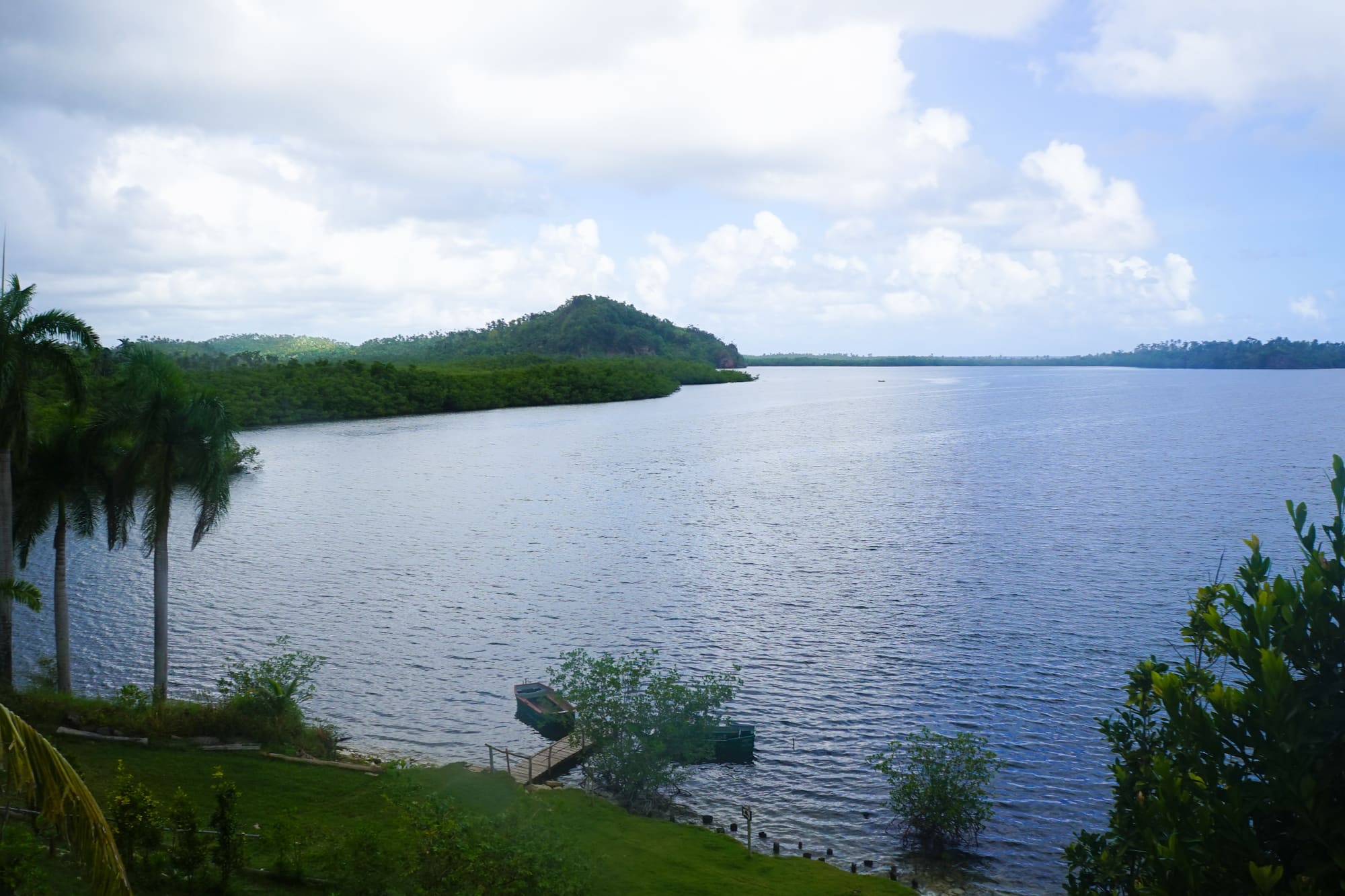
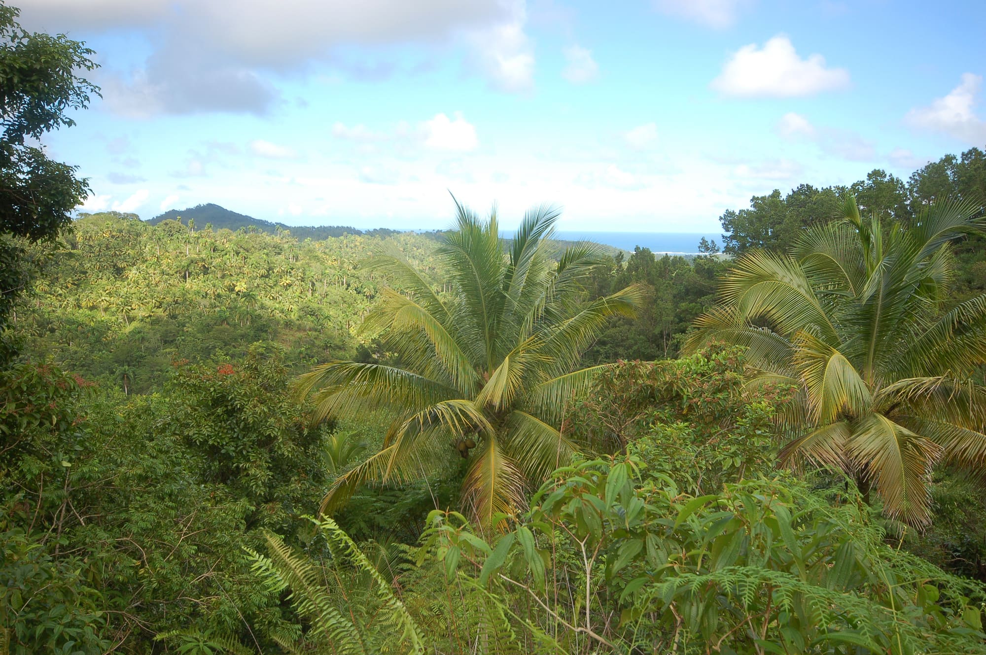
09
Planning your visit
Plan around the dry months, the hurricane season and what Cuba's travel advice currently says
Best months
- January: best
- February: best
- March: best
- April: best
- May
- June
- July
- August
- September
- October
- November
- December
January to April
- Time needed
- A full day
- Crowding at peak
- Quiet
- Access
- Visits are normally guided. The remote Ojito de Agua sector needed clearance in Guantánamo in 2016. Current permit and ticket rules could not be confirmed at the time of writing.
- Accessibility
- Accessibility information is limited; contact the site before travelling. The trails described by operators involve uneven ground, slippery rock and a boat.
- Services
- Basic servicesLimited facilities; bring water and food; accommodation some distance away
Practical details checked on
Start with the official advice. At the time of writing the UK Foreign, Commonwealth and Development Office advises against all but essential travel to Cuba, citing fuel shortages, repeated national power grid failures, disruption to transport and flights, and problems with international bank cards. Other governments publish their own advice, and a traveler should read it before booking anything.
If you do go, a full day is the minimum for the main trails and the bay, and Baracoa is the usual base. The drier months are January to April, according to the UNEP-WCMC datasheet, while most rain falls from May to October and hurricanes can arrive between August and October. Hurricane Oscar made landfall in Guantánamo province on 20 October 2024 and brought unprecedented flooding to Baracoa, so the end of the year can still be unsettled.
Operators in Baracoa describe guided visits as the normal way to see the park, with local guides who know the plants, animals and traditional medicine. We could not confirm current ticket prices, opening hours or whether guides are compulsory, so ask the park or a Baracoa operator before you travel. The remote Ojito de Agua sector needed official clearance in Guantánamo in 2016.
Take cash, since the FCDO says international cards are not being accepted and that US dollars and euros are widely taken. Keep plans loose, build in a spare day for weather, and expect services to change at short notice.
On-site services
Facilities are limited and the figures here are dated. The park's 2001 nomination file describes two small visitor centres, camping sites and a self-guided interpretive trail, and a Baracoa operator's 2017 account mentions washrooms at the entrance. Cuba's tourist board lists a lodging called Humboldt Park at kilometre 40 of the Baracoa to Moa road. Visitors should bring food, water and cash. Current opening hours, shops and mobile signal could not be confirmed at the time of writing.
10
Getting here
Baracoa is the usual gateway, reached by a famous mountain road or a small airport
The park has no single entrance. Cuba's tourist board says it is accessible both through Baracoa and through the mountain town of Yateras, and the western end near Moa, on the Holguín side, is a third approach, though one 2016 expedition was turned away there. For most visitors Baracoa, at the eastern end of the Baracoa to Moa coast road, is the practical starting point.
The province has two airports. Mariana Grajales serves Guantánamo, and Gustavo Rizo serves Baracoa, on the Jaitecico highway about 1.5 kilometres out of town. The FCDO reports that Cuban authorities say all international airports lack aviation fuel and that several airlines have suspended flights, so check what is actually flying before planning around either.
By road, Baracoa is reached from Guantánamo by the central highway and then the Farola viaduct road over the mountains, according to Cuba's tourist board. The national long-distance bus company has stations at Guantánamo, on the central highway at kilometre 2.5, and at Baracoa, near Martí Street and the Malecón. Rental cars are listed at both towns. Journey times and typical fares for each leg could not be confirmed at the time of writing.
Once in Baracoa, getting around means taxis, rented cars or motorbikes, or transfers arranged with a guide. The UNEP-WCMC datasheet places the park about 30 kilometres north-east of Guantánamo, and the coastal road runs through the park itself, with the tourist board listing a lodging called Humboldt Park at kilometre 40 of the Baracoa to Moa road. The Balcón de Iberia trail starts in the Santa María valley, and the Yateras approach ends at Piedra La Vela, up a mountain road.
For visa and entry rules, use your own government's travel advice and the Cuban authorities' consular pages, since they depend on nationality. The UK government's entry requirements page for Cuba is linked from its travel advice.
Mind the weather. Hurricane season runs from August to October, and Oscar brought flooding to Baracoa in October 2024. Fuel shortages across the country can disrupt buses, taxis and the petrol supply for rental cars, so leave slack in the schedule.
11
Local culture
Coconut farmers, cacao growers, and a music of the Baracoa countryside
Around 5,450 people live in 11 settlements inside the park, according to the IUCN's 2025 assessment. The largest was La Melba, which grew up around chromium mining and had about 400 residents in 2000, with another 4,000 or so estimated in the buffer zone at the time. Farming is concentrated in the coastal valleys of the Santa María and Nibujón rivers.
The cultural pull is Baracoa, a town founded in 1511 and presented by Cuba's tourist board as the capital of coconut, with the nearby community of Mabujabo billed as the capital of cacao. The board's guide says that in Baracoa 'the coconut is broken with the head', and it describes traditions around the cucurucho, a sweet made from grated coconut. Rural traditions have their own music: Nengón and Kiribá, rhythms of the country life of the Baracoa area, are celebrated at a festival named after them.
History runs through the mountains too. In the 18th and 19th centuries, people who had escaped slavery sheltered on the park's edges, and the memory of those palenques is part of the area's story, though the sources we found say little about what remains.
A word on what we do not know. We did not find reliable published accounts of how local communities themselves describe their relationship with the park, apart from the observation that coastal households farm coconut and cacao and that guides are drawn from nearby villages. A visitor who meets them can simply ask. The best conversations here tend to be with the people who work the land: a guide, a farmer, a woman with a basket of sweets on a trail.
Carnival in April adds a splash of color to Baracoa's year, and the town's Fiesta de las Aguas in August marks the anniversary of its foundation.
12
Anecdotes
A namesake who may never have come, a vanished woodpecker and some very small animals
The park is named after Alexander von Humboldt, but the places recorded for his visits to Cuba don't include these mountains. According to CubaPLUS Magazine, he stayed on the island from 19 December 1800 to 15 March 1801 and again from 14 March to 29 April 1804, and the places it names are Havana, Guanabacoa, the Güines plain, Batabanó and Trinidad. The UNEP-WCMC datasheet says he became known as the second discoverer of Cuba. His book on the island appeared in Paris in 1826, and the colonial authorities banned its distribution. The first Cuban printing came in 1930.
Then there is the woodpecker. Audubon magazine told how, in 2016, Tim Gallagher and Martjan Lammertink led a search for the ivory-billed woodpecker at Ojito de Agua. The government jeep stuck in the mud and was pulled free with oxen, the party spent a night at a military outpost, and the double-knock calls and a 1935 recording of the bird drew no reply. They concluded that the species is probably extinct in Cuba.
A smaller story concerns scale. The datasheet lists the Monte Iberia frog at under 11 millimetres and the bee hummingbird at 63 millimetres, and says both live in the park, along with a bat weighing two or three grams. Cuba's nomination file calls them records for the smallest of their kind. Few visitors will spot any of the three, and that is half the charm.
Last, a story from just outside the boundary. Cuba's tourist board quotes Christopher Columbus's diary describing 'a high, square mountain', which it identifies as El Yunque, the flat-topped peak beside Baracoa. It also records the Parra Cross, said to have been placed in the port of Baracoa in 1492.
13
Local cuisine
Coconut and cacao do most of the work in Baracoa's kitchens
Baracoa is known in Cuba for two crops, coconut and cacao, and most of what is distinctive to eat comes from them. The best place to start is the cucurucho, a sweet of grated coconut that Baracoa operators describe being sold on the trails near the park. Turrones, the nougat-style sweets the tourist board mentions alongside it, and coconut brittle sit nearby. A cold coconut water is a favorite after a muddy walk, and the board also lists coconut oil among the local products.
Cacao is the other half. The tourist board lists a cocoa and chocolate trail in the Baracoa area, where a guide explains the process in the plantations and visitors taste Creole chocolate at a farm. Mabujabo, a few kilometres out on the Moa road, is promoted as Cuba's capital of cacao.
Most visitors eat in town, and the stalls near trailheads are the place for something to carry. We did not find reliable current information on specific savoury dishes tied to the park itself, so the best advice is to ask at a guesthouse what is in season. Supplies can be uneven at present, so bring snacks.
14
Events and festivals
Three Baracoa celebrations that set the rhythm of the local year
Last week of March
Baracoa Culture Week
Cuba's tourist board describes a week of dance and art, from the aboriginal to the modern, with fairs and exhibitions and wide popular participation in Baracoa.
April
Baracoa Carnival
Annual carnival celebrations in Baracoa with conga parades, folk characters, culinary exhibitions and other displays of local tradition, according to Cuba's tourist board.
10 to 15 August
Fiesta de las Aguas
A yearly festival in Baracoa marking the town's anniversary, with commemorative popular activities, as listed by Cuba's tourist board. Check dates locally before planning around it.
15
Challenges
Illegal mining, fire, invasive animals and hurricanes press on a very small place
The park has been the subject of recent conservation concern, centred on illegal gold mining, fire and invasive species. It remains on the World Heritage List, and its managers work to a 2021–2025 management plan. The IUCN World Heritage Outlook, finalised in October 2025, rates the overall outlook as good with some concerns, and the threats as high. The condition of the park's plants and animals is judged to be stable and of low concern, but pressure on the edges is real.
- Illegal gold mining began in 2013 and involved more than 1,800 people by 2015. The IUCN reports it has affected about 27 hectares of forest and some 47 kilometres of watercourses.
- A fire between 17 April and 6 May 2021 burned about 1,896 hectares at Ojito de Agua. The IUCN links the fire to illegal mining in the area.
- Between 2000 and 2006 the state granted or confirmed eight mostly peripheral nickel concessions. The two largest, La Farragosa and Las Iberias, cover about 40 per cent of the property. They had not been worked at the time of the 2012 datasheet.
- Introduced animals, including black rats, feral cats, dogs and small Indian mongooses, are found across most of the park, along with invasive plants such as Syzygium jambos and Dichrostachys cinerea.
- Hurricane Matthew in 2016 affected about 8,928 hectares, or 12 per cent of the park. The IUCN expects hurricanes to become more frequent and severe and projects warming of 2.5 to 5°C by 2100.
- Resources are thin. The IUCN notes that rangers lack legal authority to issue sanctions and that no robust monitoring programme exists, with the government paying all operating costs.
16
Travelling responsibly
Small habits that matter in a place where many species live in tiny patches
- Go with a local guide. The guides come from nearby communities and know the trails and the rules.
- Please stay on marked paths. Some of the plants here live in a single patch of only a few square metres.
- Do not collect snails, plants or animals. Painted Polymita snails, iguanas and jutía are among the species the IUCN says are taken.
- Keep your distance from manatees in Taco Bay and never try to touch or feed one.
- Take every scrap of rubbish out with you. Introduced rats, cats and dogs are already widespread, and food scraps do the native animals no favours.
- Do not light fires or drop cigarettes, especially in the dry months. A 2021 fire burned about 1,896 hectares.
- Buy sweets and snacks from local sellers on the trails, and carry cash. It is one of the few direct ways to support the villages.
17
In the news
Recent reporting, summarised
· OnCuba News
El huracán Oscar cambió la faz de Guantánamo, asegura una investigación ambientalA study of Hurricane Oscar's effects on Guantánamo province describes lasting changes to coasts and slopes, and a scientist from the park's environmental unit calls some of them permanent.
18
Frequently asked questions
The questions travellers ask most
Do I need a guide to visit the park?
Probably. A Baracoa operator's 2017 account describes a guide as compulsory, drawn from nearby communities, and Cuba's tourist board presents the trails as guided excursions. We could not confirm the current rule, so ask the park or an operator in Baracoa before you set out.
How many days do I need?
One full day covers the bay and one main trail such as Balcón de Iberia. Two days lets you add a second trail or the Río Jiguaní. The remote back-country sectors need official clearance and planning well beyond a normal visit.
When is the best time to go?
January to April is the drier stretch, according to the UNEP-WCMC datasheet. Rain can still arrive at any time, and hurricanes are a risk from August to October. Whenever you go, pack for wet weather and slippery ground.
Will I see manatees in Taco Bay?
Maybe. A Caribbean manatee colony lives in the marine sector, and an operator says animals sometimes approach the boat. Nobody can promise a sighting, so treat it as a bonus and enjoy the mangroves and the birds.
Can I still see the ivory-billed woodpecker here?
Almost certainly not. The birds were reported at Ojito de Agua in 1986, and searches since, including an expedition in 2016, found nothing. The people who looked for it have concluded it is probably extinct in Cuba.
Is it safe to travel there at the moment?
We can't give safety guarantees. The UK FCDO currently advises against all but essential travel to Cuba because of fuel shortages, power cuts and disrupted transport. Read the latest advice from your own government before you decide.
19
Location
Baracoa to the east, Moa's mines to the west and a long, thin park in between
The park sits in the far east of Cuba and runs along the coast, with Baracoa at one end and Moa at the other. Baracoa, which Cuba's tourist board calls the first city of Cuba, founded in 1511, is the practical base: it has the airport, a bus station, rental cars, places to stay and the operators who run park trips. Its small centre also has a fort museum and a cathedral.
To the west, Moa is a mining town, with a nickel-mining zone downstream of the park. Guantánamo, the provincial capital, lies to the south-west and is where the park's main administration is based. Yateras is the mountain municipality used for the south-western approach. Sagua de Tánamo, in Holguín province, is the other municipality that shares the park's land.
The surrounding Cuchillas del Toa Biosphere Reserve covers the park and more, including El Yunque, the flat-topped hill beside Baracoa, which stands at 576 metres. Beaches such as Maguana and Mapurisí lie along the coast near Baracoa, and the Toa is described as the mightiest river in Cuba. Ask a driver or guide for distances from Baracoa along the Moa road; the lodging listed at kilometre 40 is a useful marker.
Alejandro de Humboldt National Park is about 55 km north-east of Guantánamo. The nearest other World Heritage site is First Coffee Plantations, Cuba, about 75 km away.
Nearest towns and cities
- Guantánamo · about 273,000 peopleabout 55 km south-west
- Banes · about 53,000 peopleabout 100 km north-west
- Santiago de Cuba · about 556,000 peopleabout 110 km south-west
- Palma Soriano · about 103,000 peopleabout 120 km west
- Holguín · about 319,000 peopleabout 150 km west
- Bayamo · about 193,000 peopleabout 190 km west
20
Around the site
Places worth the detour, and the nearest World Heritage neighbours
Baracoa historic town
Founded in 1511, Baracoa is the main base for the park. Cuba's tourist board points to its cathedral, the Matachín fort museum and the Parra Cross, said to have been placed in the port by Christopher Columbus in 1492. A morning in town fits well before or after a day on the trails.
El Yunque
The flat-topped mountain beside Baracoa, reaching 576 metres, is a national monument and the symbol of the town. Cuba's tourist board describes a trail of medium difficulty from a camping base up to the plateau, crossing a river on the way. It pairs well with the park as a second hike.
Maguana beach
One of the beaches along the coast near Baracoa that Cuba's tourist board names among its best, together with Cajuajo, Mapurisí and Playa Miel. It is an easy place to rest after a muddy trail, and a Baracoa operator describes Maguana as the more popular and Mapurisí as the quieter option.
Cacao route at Mabujabo
Mabujabo, at kilometre 3 of the Moa road, is promoted by Cuba's tourist board as the capital of cacao, with a cocoa and chocolate trail where a local guide explains the process and visitors taste Creole chocolate. It fits neatly into a half day around Baracoa.
3 km by road
Punta de Maisí
The easternmost tip of Cuba, in Maisí municipality, known for its lighthouse and the large marine terraces called Escalones de Gigantes. Cuba's tourist board describes cave areas such as Pozo Azul nearby. It makes a long day trip from Baracoa for people who want coast and geology.
Nearby World Heritage sites
CubaCultural76 km away
CubaCultural121 km away
HaitiCultural292 km away
CubaNatural298 km away
JamaicaCultural353 km away
21
Further resources
Books, links and people who know the ground
Books
- Political Essay on the Island of CubaAlexander von Humboldt, 2011
- The Grail Bird: Hot on the Trail of the Ivory-billed WoodpeckerTim Gallagher, 2005
Links
The official record
- World Heritage Centre page for this sitewhc.unesco.org
Trip reports
No one has written up a visit to Alejandro de Humboldt National Park yet. If you have been, we would like to hear how it went.
Been here? Share a trip reportGuest reports are credited and edited with you before they appear.
Suggest a correction or additionEvery message is read by an editor.
Last reviewed