Landscape of Bamiyan Valley
Also known as Cultural Landscape and Archaeological Remains of the Bamiyan Valley, Bamyan Valley, Buddhas of Bamiyan
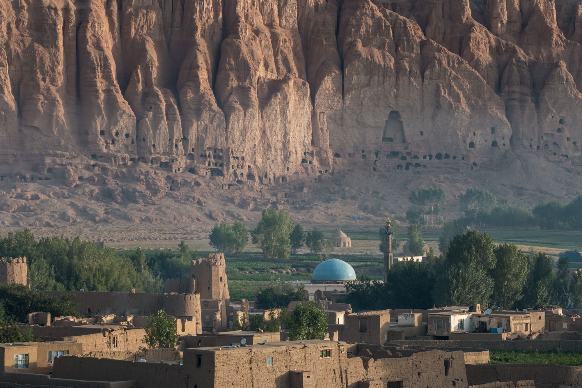
Two vast empty niches in a sandstone cliff, and the Buddhist valley around them.
01
Introduction
Caves, monasteries and two giant niches in a sandstone cliff above a farming valley
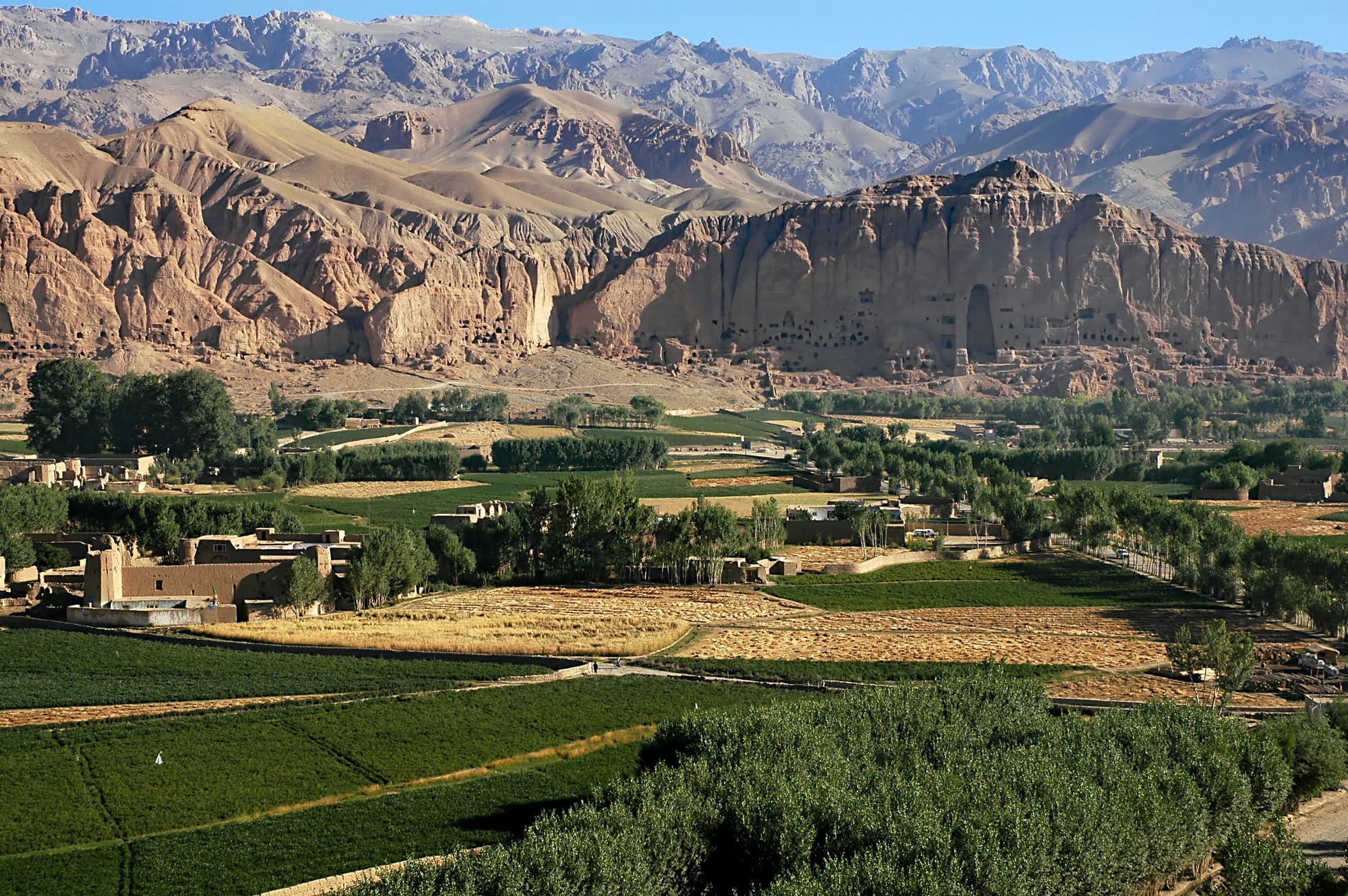
The Cultural Landscape and Archaeological Remains of the Bamiyan Valley lies in the central highlands of Afghanistan, about 180 kilometres from Kabul. It's a high valley between the Hindu Kush and the Koh-i-Baba range. Potato fields on the valley floor, a long sandstone cliff to the north. In that cliff: two huge niches, cut for Buddhas 38 and 55 metres tall, and hundreds of smaller caves.
The Buddhas are gone. The Taliban destroyed them in March 2001, and the niches have stood empty since. What's left is still a lot. Painted caves where monks lived, with some of the earliest clear examples of oil painting anywhere. A ruined citadel in the middle of the valley, a ruined fortress at its mouth. One of the people who drew up the town's master plan calls it the furthest west Buddhism ever reached.
It's a living place too. Families live in some of the caves, and the town below is the provincial capital. UNESCO inscribed the valley, meaning it formally added it to the World Heritage List, in 2003, and put it on the List of World Heritage in Danger the same year. It's still there. Anyone thinking of going should read Planning your visit first.
02
History
Monks, pilgrims and sieges, then a few weeks in 2001 and the long argument since
Bamiyan was a Buddhist place long before anyone carved a giant. It sat on a trade route linking India, Central Asia and China, and monks cut caves into the soft sandstone of the north cliff to live and pray in. National Geographic calls it a bustling Silk Road stop and a center of Buddhist study. By the early 630s the Chinese pilgrim Xuanzang reported about 10 monasteries and more than a thousand monks.
Then the statues. Two Buddhas, 38 and 55 metres tall, were cut from the cliff and set in deep niches. Locals call the larger one Salsal and the smaller Shahmama. The monks' cave cells around them were painted too, and a research team later dated that painting to between the 5th and 9th centuries. The rock was only the core. Wooden pegs and timbers, tied with rope, held layers of clay mixed with straw, animal hair and quartz, and the folds of the robes were modelled in that clay. Paint went on top, more than once. The original color scheme ran from dark blue to pink, red, white and orange, according to the team that studied the rubble.
For a long time the dates rested on style, and most scholars placed the statues a century or two too early. After 2001, tests on organic material in the clay gave 544 to 595 for the smaller Buddha and 591 to 644 for the larger. So Xuanzang saw them fairly new. It also means Buddhism was still thriving in the valley as Islam spread through the region.
The monasteries declined after Islam arrived in the 8th century, over a century or two. Conquerors followed: Mahmud of Ghazni in the 11th century and, in 1221, a Mongol army under Genghis Khan. The hilltop citadel of Shahr-i Ghulghulah, in the middle of the valley, is now known as the City of Screams. Over the centuries some Muslims defaced the statues and the cave paintings. That defacing occured slowly, alongside the weather. Even so, the Buddhas still dominated the valley.
By the 1990s the valley was a front line. A French photographer who reached it in 1996 found Hazara fighters storing weapons in the caves, and refugees returning from Pakistan living in them. Months later the Taliban took Kabul. At first they left the Buddhas alone and, after a commander shot at the statues, ordered Afghan heritage protected.
That changed in March 2001. Artillery fire began on 2 March and did little. Explosives placed up and down the figures did the damage, and by the end of the month the 1,500-year-old statues were gone. National Geographic ties the decision to frustration at a lack of international recognition and tougher American sanctions.
The rubble became evidence. A team led by Erwin Emmerling of the Technical University of Munich went through it. The blast had thrown out wooden pegs and timbers, and these gave the first clues to how the figures were built, and the first scientific dates. The valley was inscribed in 2003, on the Danger list from the start. In 2008 scientists reported oil in the paint of 12 of about 50 caves, from the mid-7th century. Rebuilding stayed contested. Afghan officials wanted at least one Buddha back; UNESCO held that a copy would be a reproduction, not a reconstruction. 'The void is the true sculpture,' a UNESCO consultant said in 2012. In 2013 a German team built brick legs in the smaller niche without authorisation, and UNESCO objected strongly. Afghan officials, donor countries and experts were still discussing, in 2016, whether at least one statue could be rebuilt. Since August 2021 the Taliban have run the site as a ticketed attraction, and in September 2025 the expert working group met again, in Japan.
03
Timeline
Fourteen dates, from the carving of the Buddhas to the latest Committee decision
Smaller Buddha carved, according to scientific dating of organic material in its clay
Larger Buddha carved, dated by the same tests
Chinese pilgrim Xuanzang visits and reports about 10 monasteries and over a thousand monks
Cave paintings made, some in oil, centuries before oil painting appears in Europe
Islam arrives in the region; the monasteries decline over the following century or two
Mongol forces under Genghis Khan invade the valley
Hazara fighters store weapons in the caves as returning refugees shelter there
Taliban destroy both Buddhas with artillery fire and explosives
Valley inscribed on the World Heritage List and, the same year, on the List in Danger
Scientists announce oil paint in 12 of about 50 caves studied
German conservators build brick legs in the smaller niche; UNESCO objects
Taliban return to power and begin running the site as a ticketed attraction
Bamiyan expert working group resumes meetings, in Japan
Committee again retains the property on the List of World Heritage in Danger
04
Why visit
What an absence can show, and what the cliff still holds
The first thing is simply what's missing. Two niches in a sandstone cliff, cut for statues 38 and 55 metres tall, are now empty, and the cliff around them is pocked with caves. A Chinese pilgrim who passed in the early 630s found the statues brightly painted and decorated with gold and jewels, and the rubble later confirmed several layers of paint. Few places show a loss so plainly. Standing at the foot of the cliff, a visitor can judge the scale of what stood there without needing a single photograph.
The place also explains how it was made. Rubble studied after 2001 showed a rock core, a wooden frame fixed with rope, clay shaped into robes and layer after layer of paint. The caves behind show where monks lived and worked, and their walls once carried paintings made between the 5th and 9th centuries. In some, the binder in the paint was oil. Researchers called that the earliest clear example of oil painting in the world.
Then there's what it says about people and belief. The monks' caves were cut into the same sandstone as the giants, so devotion and daily life shared a single rock face. One of the authors of the valley's master plan describes Bamiyan as the furthest west Buddhism reached, and the paintings were probably made by artists travelling the Silk Road. Caves farther along the cliff are lived in by families today, so the valley isn't a museum behind glass. The farming goes on below it.
And it's one of the most closely studied cases of what happens after deliberate destruction. Scientists sorted through the rubble. An international expert group has argued since 2002 over whether anything should be rebuilt. UNESCO's line has been that a copy wouldn't be the original. Few places hold both the ruins and the argument about them.
05
The setting
A cold farming valley at about 2,500 metres, with the sites strung along it
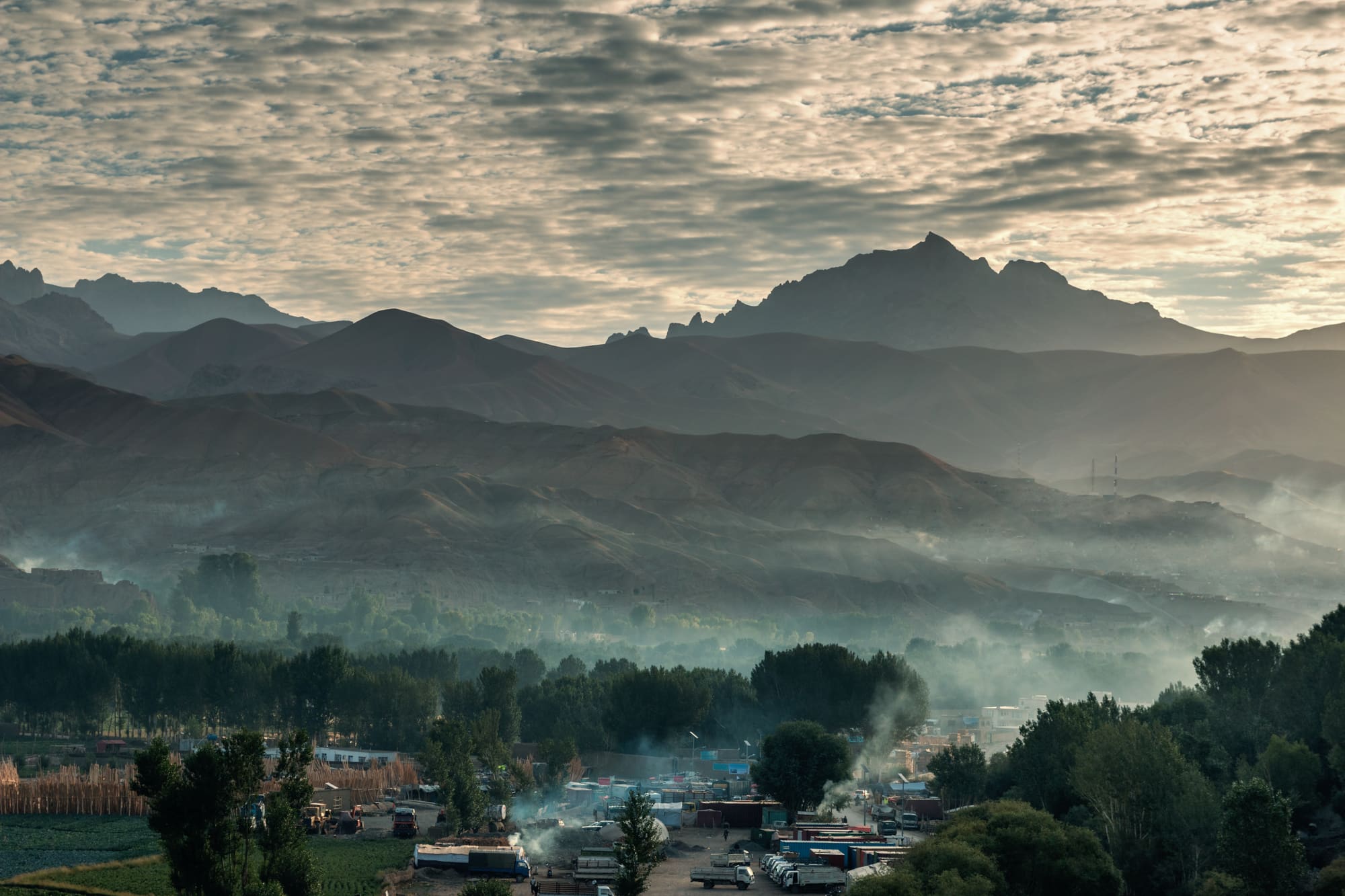
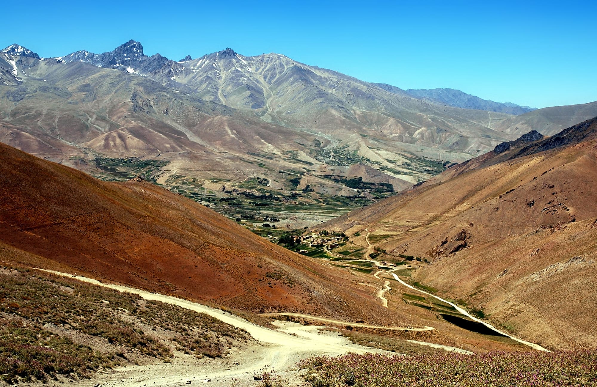
Bamyan is a high valley in the central highlands, wedged between the Hindu Kush and the Koh-i-Baba range. The provincial town sits at roughly 2,500 metres and about 180 kilometres from Kabul. Potato fields surround it, and snow-capped mountains stand behind. The long sandstone cliff with the niches runs along the north side.
Winters are harsh. A 2014 report said temperatures fall far below zero and most hotels close because their pipes freeze. It's also, by Afghan standards, a green place: a provincial official once called Bamyan the country's greenest province.
What UNESCO protects isn't one monument but several seperate areas scattered along the valley. Recent Committee decisions name the Bamiyan Buddha cliffs with their two niches, Shahr-i Ghulghulah, Kakrak and Shahr-i Zuhak. Together the inscribed core covers about 159 hectares. Around it sits a buffer zone, a protective margin where building is meant to be controlled, of about 342 hectares.
Everything's close to town. The cliff sits at its edge and the citadel of Shahr-i Ghulghulah stands in the middle of the valley. The Red City, Shahr-i Zuhak, guards the valley's entrance. Kakrak is a secondary site near the niches. The town has grown into the inscribed land, and that's one of the Committee's main worries (see Challenges).
06
Key places
A cliff, two niches, a citadel and a fortress, all within reach of the town
The Buddha cliff
The long sandstone cliff on the north side of the valley holds everything most people come for: the two big niches and hundreds of smaller caves around them. The western niche once held the 55-metre Buddha; the eastern one, the 38-metre figure. Scaffolding stood in the niches in 2021, and in 2023 a ticket office was reported at the foot of the larger one, with armed guards beside it. Give it a slow hour at the base, then look up at the caves. Some are homes, so observe from a distance.
The Eastern niche
The smaller niche held the 38-metre Buddha, and it's where a German-led team stabilised the rear wall. In 2013 the team built brick shapes of legs and feet into the niche. UNESCO said the move was unauthorised and caused irreversible damage. Nobody has touched the niches since, as far as a 2014 report could tell. Look at the rock behind the brickwork: that's the original cliff, and it's the part that matters. Allow time to see it from the front and from above.
The Western niche
The larger niche is where the 55-metre Buddha stood, and it's the harder one. UNESCO reported urgent conservation work there in 2016, using scaffolding donated by a German foundation. The ground in front is archaeologically sensitive, which is why the Committee has pressed for any plan to bring back the Old Bazaar, destroyed in the 1990s, to be moved elsewhere. In 2022 reporters also found a coal depot set up in front of it. Check with your guide what's accessible.
Shahr-i Ghulghulah
A fortified citadel on a hill in the middle of the valley, dating from between the 6th and 10th centuries. Its name is usually translated as the City of Screams. The Committee asks for detailed reporting on excavations here, and in 2022 reporters found its archaeological depot looted and unguarded, with trenches more than three metres deep. Expect rough ground. Ask whether the citadel is open before you plan around it.
Kakrak
A secondary site near the Buddha niches, and one of the areas named in the Committee's decisions. Emergency works have been funded here by UNESCO projects. A wall-painting fragment from Kakrak is now in the Musée Guimet in Paris. Whether the site is open to visitors, and what you'd see, could not be confirmed at the time of writing, so ask a local guide and don't assume that it is open.
Shahr-i Zuhak (the Red City)
A fortress about 1,500 years old at the meeting of two rivers, at the entrance to the valley. It's known as the Red City. A 2014 report said it was less than 10 miles east of the town but a half-hour drive, partly on rough road, and that it was used as a hideout in 2001, with spent bullet cases still on the ground. Mines were scattered around the province in the wars, and an old explosive killed seven children there in 2014. Stay on tracks.
07
What to expect
Thin air, empty niches, armed guards at the ticket office and very few other visitors
Bamyan is small. A bazaar, a main road, potato fields to the edge of town. In the afternoon, a 2014 report says, kebab smoke drifts down the main street and motorbikes kick up dust. The cliff is right there, so you don't need a trek to see the niches. The town sits at roughly 2,500 metres, so expect thin, cold air outside summer, and in winter a proper freeze.
You'll meet security. Reports from 2021 and 2023 describe soldiers writing tickets in a booth under a white Taliban flag, and armed guards at the foot of the larger niche. Photography rules weren't clear in any source we found, so ask your guide before pointing a camera at a person, a checkpoint or an official.
Crowds? Almost none. A visitor in 2024 told CNN he had the ruins nearly to himself, and NBC and the Washington Post both found few visitors on their trips. That's pleasant, in a way. It also means nobody else is around if something goes wrong.
The niches themselves are the surprise. They're simply big, and they're empty. Scaffolding was still standing inside in 2021. The caves around them are mostly empty too, but those farther along are homes: washing on lines, children playing, a few with glass windows. Don't peer in.
Stay on paths and tracks. Mines were scattered around the province in the wars, and in 2014 an old explosive washed down from the hills killed seven children. And don't assume your phone will work once you leave town.
The thing most travelers mention afterwards isn't the ruins. It's the hospitality. Visitors quoted by CNN describe being invited for tea and food by almost everyone they met. Women visitors are generally free to explore as men do, according to a tour company quoted by CNN, but Afghan women face tight limits on public life, so dress and behave with care.
08
Photographs
More of the place, as it looks on the ground
09
Planning your visit
Official advice says do not go, so any trip starts with a hard look at the risks
- Crowding at peak
- Quiet
- Access
- A visa is required. Tourist visas are normally issued on an invitation letter from a registered Afghan tour company. Tickets were sold at an office at the foot of the larger niche in 2023; current rules could not be confirmed.
- Accessibility
- Accessibility information is limited; contact the site before travelling
Practical details checked on
Start with the official advice. The UK government (the FCDO) advises against all travel to Afghanistan, even as part of an organised tour group. It says British nationals face a high risk of detention or kidnap, that there is no British embassy, and that your travel insurance could be invalid if you go against the advice. Other governments publish their own advice. Read yours, not ours.
Bamyan itself has not been immune. In May 2024 gunmen attacked a group walking through the bazaar and killed three Spanish tourists and three Afghans. No group claimed responsibility, and the authorities said it was the deadliest attack since 2021.
If you decide to go anyway, you'll need a visa. CNN reported in 2024 that visas are normally issued on an invitation letter from an Afghan tour company, and that those companies must be registered with the Ministry of Culture. Recent reporting describes most visitors travelling on private tours with a local guide.
Season matters. A 2014 report said most hotels close in winter when the pipes freeze, and the cold is severe. We couldn't confirm the best months from a reliable climate source.
Entry fees were reported in 2021 and 2023 at a few US dollars for foreigners, paid at a ticket office. Current prices, opening hours and permit rules could not be confirmed at the time of writing, so ask your operator.
On-site services
Could not be confirmed at the time of writing.
10
Getting here
Kabul is the gateway, the rules are strict and most practical detail is unconfirmed
Start in Kabul. Bamyan is about 180 kilometres from the capital. Beyond that fact, we couldn't find a source we could trust for how people get there now: the road routes, any scheduled flights, journey times or fares. A 2014 report described a small airline flying three times a week and a road through Wardak province that locals called dangerous, but neither can be taken as current. Could not be confirmed at the time of writing.
The FCDO is clear that you shouldn't travel to Afghanistan, and says a number of border crossings are not currently open. Tensions between Afghanistan and Pakistan have led to violent clashes in border regions. Check which crossings are open before you plan anything overland.
You need a visa. The Afghan embassy in London is closed, so British travellers can't use it. CNN reported in 2024 that visas come from consulates in places such as the United Arab Emirates and Pakistan, and from embassies in countries including Germany, Spain and the Netherlands, normally against an invitation letter from a registered Afghan tour company. Rules differ by nationality and change. Check your own government's travel advice and the website of the Afghan mission that serves you.
Money and health rules are strict. The FCDO says it is illegal to carry more than 5,000 US dollars in cash through airports, or more than 500 US dollars across land borders. On departure you may be asked for a certificate showing a polio vaccination. Declare anything that might be prohibited or subject to duty. Its entry-requirements page has the details and links to the TravelHealthPro guide for health advice.
Most visitors in recent reporting went with a tour company rather than on public transport. CNN's 2024 interviewees travelled on private tours with local guides, and the Ministry of Culture requires those companies to register. Ask the operator about the route, the journey time and who will meet you.
Once in Bamyan, the cliff is at the edge of town, and the other main areas are within a short drive, though a 2014 report found the Red City took half an hour by road for under ten miles. Ask your operator which sites are open and how to reach them. Expect checkpoints.
11
Local culture
A Hazara-majority province of farmers, with caves that are still homes
Bamyan is Hazara country. The Hazara live mainly in Afghanistan's central highlands, and the Bamyan valley sits at the heart of that region. In 2014 a reporter put them at between 10 and 15 per cent of all Afghans, with another large community in Kabul. We found no reliable current figures for the province itself.
Most families farm. Potatoes are the crop visitors notice first, in fields that run to the edge of town, and in 2011 the provincial authorities were planning 350 potato stores and handing out tractors. A provincial agriculture official described Bamyan that year as Afghanistan's greenest province.
Some families live in the cliff caves. NBC reported in 2021 that the caves around the Buddhas were empty, while others farther away had washing lines, playing children and glass windows. That's housing, not a display.
The calendar has had its celebrations. At Nowruz, the new year at the start of spring, the provincial festival in 2011 saw families visit ancestors' graves and light the mountainside caverns, with local music and a handicrafts exhibition, and ski races the next day. A festival in 2014 added langi, a one-legged tussling game, plus wrestling, tug-of-war and the danbur, a two-stringed instrument. Whether these are held now could not be confirmed.
Hazara history here is painful. A reporter writing in 2014 noted that Hazaras had faced varying levels of oppression for five centuries, that the Taliban had driven many out of the area in the 1990s, and that many came back after 2001. That memory sits behind the way people in Bamyan talk about the Buddhas and about the authorities today.
Rules on public life, especially for women, are strict. CNN reported that women have been barred from parks and from long journeys without a male relative. Foreign visitors are advised by their guides on conduct locally.
12
Anecdotes
A pilgrim's note, a bus ride, a missing giant and a sculpture in New York
In 721 a young Korean monk, Hyecho, crossed Asia on foot and by sea and reached Bamiyan. His account turned up in the Library Cave at Dunhuang in China, where the French scholar Paul Pelliot found it in 1908. He recorded cold, snow, many monasteries following both the Mahayana and the older Hinayana traditions, and a king and commoners who revered the Three Jewels of Buddhism. Not a bad review, for the cold.
Engravings kept the statues in view abroad. One, titled The Colossal Idols at Bameean, was published with Alexander Burnes's Travels into Bokhara in 1834.
In July 1996 the French photographer Pascal Maitre tried three times to reach the valley from Kabul. Drivers kept cancelling because armed groups were seizing cars at checkpoints. He got through on a rented city bus full of commuters, wearing a loose Afghan tunic and trousers. He thinks his photographs were among the last of the Buddhas still standing.
Maitre went back in 2006 and found, in his words, 'a big hole, and nothing left'. Afghan archaeologists were there, hunting for a third Buddha: a long-fabled figure, bigger than the other two and carved lying down. They hadn't found it when he left.
And in 2026 a 27-foot sandstone sculpture inspired by one of the Buddhas, carved in Vietnam by the artist Tuan Andrew Nguyen, was due to go on show in spring 2026 on the High Line in New York. The press release calls it a call to remembrance, and a counterpoint to extremism.
13
Challenges
A cliff, a town and a plan that have to be managed together, with outside help restricted
Since 2003, the site has been on the List of World Heritage in Danger, the mechanism the World Heritage Committee uses to draw attention and support to places whose values are under serious threat. The main concerns are the stability of the cliff and niches, uncontrolled building inside the valley, and the protection of excavated remains and artefacts. In 2026 the Committee kept the property on the list again. It asked for a management plan and a revised action plan, the steps that would lead to its removal from the List in Danger. UNESCO-run projects, paid for by Japan and Italy, continue at the cliffs, the niches and several other areas.
- Housing and infrastructure are growing inside the property's boundaries. The Committee calls urban management a major challenge and recommends protecting the landscape, revising the buffer zones and adopting a clear land-use scheme.
- Several projects are under review: roads near Ghulghulah and Tepe Almas, an energy supply scheme and a Zohak access road. The Committee wants nothing difficult to reverse decided before the plans are examined by its advisers.
- The Old Bazaar, destroyed in the 1990s, may be rebuilt near the Western niche, where the ground is archaeologically sensitive. The Committee has asked for a technical proposal and for an alternative location to be considered.
- The cliff and niches remain fragile. A former UNESCO coordinator for Bamiyan said the 2001 explosions left cracks up to 30 metres deep, and in 2022 warned the cliff could collapse within ten years without proper management.
- In 2022 reporters described looting, illegal building and unplanned excavation near the Western niche and at Shahr-i Ghulghulah, including a looted archaeological depot. The Committee keeps asking for a full report on the condition of artefacts.
- Planning and funding are fragile. The Committee still awaits a draft Management Plan, and work depends on donor projects, with outside archaeologists withdrawing after 2021.
14
Travelling responsibly
Small decisions that matter in a damaged and sensitive place
- Read your government's current travel advice before you decide to go: insurance can be invalid if you travel against it.
- Stay on paths and tracks, as old mines and explosives have injured people in Bamyan province, including seven children in 2014.
- Don't climb on ruins or pick anything up: sites such as Shahr-i Ghulghulah have been looted and excavated, and every loose fragment is evidence.
- Treat caves that are still homes as private houses. Observe from a distance and ask before photographing anyone.
- Dress modestly and follow your guide's advice on conduct, particularly for women, because public life is tightly restricted.
- Think about where the money goes. CNN reported disagreement over whether tourism helps local people or lends the authorities legitimacy.
- Use a local guide and local businesses where you can, so that spending reaches families in the province.
15
Frequently asked questions
The questions travellers ask most
Is it safe to visit Bamiyan?
The UK government advises against all travel to Afghanistan, even with an organised tour group, and warns of detention, kidnap and terrorism. In May 2024 gunmen killed three Spanish tourists and three Afghans in Bamyan's bazaar. Check your own government's advice before you decide.
Can you still see the Buddhas?
No. Both statues were destroyed in March 2001. You can see the two empty niches, some scaffolding and the caves around them. Fragments of the statues have been collected and studied.
Will the Buddhas be rebuilt?
Not at present, as far as we could confirm. Afghan officials have wanted at least one back, and the question was discussed in 2016, but UNESCO has argued that a rebuilt statue would be a reproduction, not a reconstruction. The latest Committee decision doesn't call for rebuilding.
Why is Bamiyan on the List of World Heritage in Danger?
It was inscribed on the List in Danger in 2003, the same year it joined the World Heritage List. The Committee keeps it there because of concerns about site security, the stability of the cliff and niches, unplanned building and the state of the remains. It was retained again in 2026.
Do I need a visa?
Yes. The UK government says a visa is required and that the Afghan embassy in London is closed. CNN reported in 2024 that visas are normally issued on an invitation letter from a registered Afghan tour company. Check the rules for your nationality.
Who lives in the valley today?
Bamyan province is mostly Hazara, according to an older profile, and most people farm. Some families live in caves in the cliff. The town below the cliff is the provincial capital.
16
Location
A provincial capital in the Hindu Kush, 180 kilometres from Kabul
Bamyan is the provincial capital and the only real base for visiting the valley. It's about 180 kilometres from Kabul, in the central highlands between the Hindu Kush and the Koh-i-Baba range. The town is small, with a bazaar, a main road and fields of potatoes, and the Buddha cliff runs along its northern edge.
West of town, a long drive on rough road leads to Band-e Amir National Park, Afghanistan's first national park, with six deep blue lakes about 50 miles away according to a 2014 report. To the east lies the Red City, at the valley's entrance. Skiing happens in the Koshak Valley in winter, with races held there at Nowruz in 2011.
Facilities in town are limited. In 2023 reporters found a main hotel fenced with barbed wire, and a 2024 visitor stayed in a hotel with views of the niches. Beyond the town, the province is mountainous, and 2014 reporting found mobile reception disappearing within minutes of leaving it. Plan accordingly, and take advice from your operator before moving between sites.
Landscape of Bamiyan Valley is about 30 km east of Bamian. The nearest other World Heritage site is Tigrovaya Balka, about 280 km away.
Nearest towns and cities
- Bamian · about 62,000 peopleabout 30 km west
- Mayda Shahr · about 35,000 peopleabout 100 km south-east
- Charikar · about 54,000 peopleabout 120 km east
- Kabul · about 3,277,000 peopleabout 130 km east
- Baraki Barak · about 22,000 peopleabout 140 km south-east
- Pol-e Khomri · about 56,000 peopleabout 150 km north-east
17
Around the site
Places worth the detour, and the nearest World Heritage neighbours
Band-e Amir National Park
Afghanistan's first national park, a set of six deep blue lakes among reddish cliffs, about 50 miles west of Bamyan according to a 2014 report, with a dirt road at the end. CNN has reported that Afghan women are no longer allowed to visit. Ask your operator whether it is open to you.
80 km by road
National Museum of Afghanistan, Kabul
Kabul's national museum opened a section for Buddhist artefacts in May 2023, with senior Taliban officials at the inauguration, according to the Washington Post. Bamyan is about 180 kilometres away, so it fits at the start or end of a trip. Check what is on display before you go.
180 km by road
Koshak Valley
A valley near Bamyan where ski competitions and snow races were held on the last day of the 2011 Nowruz festival, and a 2014 report called it the country's only ski slope, without a lift. It's a winter prospect, in the months when many hotels have closed.
Nearby World Heritage sites
TajikistanNatural276 km away
TajikistanCultural362 km away
PakistanCultural381 km away
PakistanCultural474 km away
UzbekistanCultural477 km away
18
Further resources
Books, links and people who know the ground
Books
- The Buddhas of BamiyanLlewelyn Morgan, 2012
- The Giant Buddhas of Bamiyan: Safeguarding the RemainsMichael Petzet, Michael Jansen and Erwin Emmerling (editors), 2009
Links
The official record
- World Heritage Centre page for this sitewhc.unesco.org
Trip reports
No one has written up a visit to Landscape of Bamiyan Valley yet. If you have been, we would like to hear how it went.
Been here? Share a trip reportGuest reports are credited and edited with you before they appear.
Suggest a correction or additionEvery message is read by an editor.
Last reviewed