Matobo Hills
Also known as Matopos Hills
Granite domes holding over 3,000 rock art sites and a living oracle.
01
Introduction
Bare granite, thousands of painted shelters and a landscape that is still in use
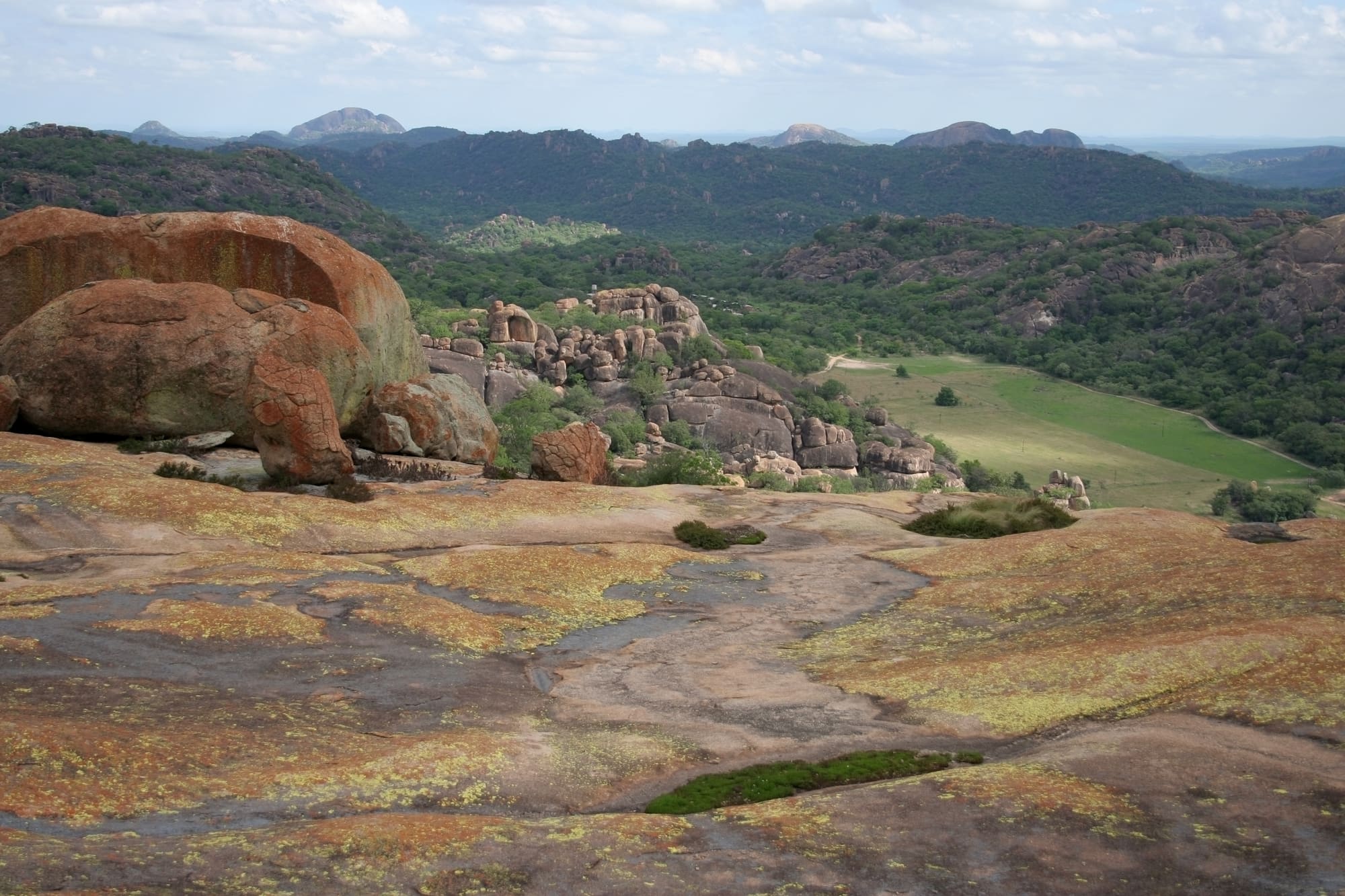
Matobo Hills, in south-western Zimbabwe, is a landscape of bare granite: smooth domes, stacks of balanced boulders and narrow wooded valleys, beginning about 35 kilometres south of Bulawayo. The landscape covers roughly 3,100 square kilometres. Matobo National Park, set up in 1926, takes up 424 of them, and most of the rest is communal land with a little commercial farming. It was inscribed on the World Heritage List in 2003, which is the register of places that the World Heritage Committee judges to have Outstanding Universal Value, meaning importance beyond any one country.
Two ideas hold the rest of this page together. The first is that people have sheltered and painted in these rocks for a very long time: more than 3,000 rock art sites are known, most of them made by hunter-gatherers. The second is that the hills are not a closed chapter. For centuries they have been tied to an oracle of the high god Mwari, also called Mlimo, and several of its shrines are still in use. The grave of Cecil Rhodes is one of the most visited places here, and for many people the only part of the hills they see. The paintings repay a longer stay.
The hills are also somebody's home. Families graze cattle and goats on the communal land, the national park shelters black and white rhinos, and keepers look after shrines that outsiders may approach only on the keepers' terms.
02
History
From granite that formed underground to the painters, farmers, kings and settlers who each claimed the hills
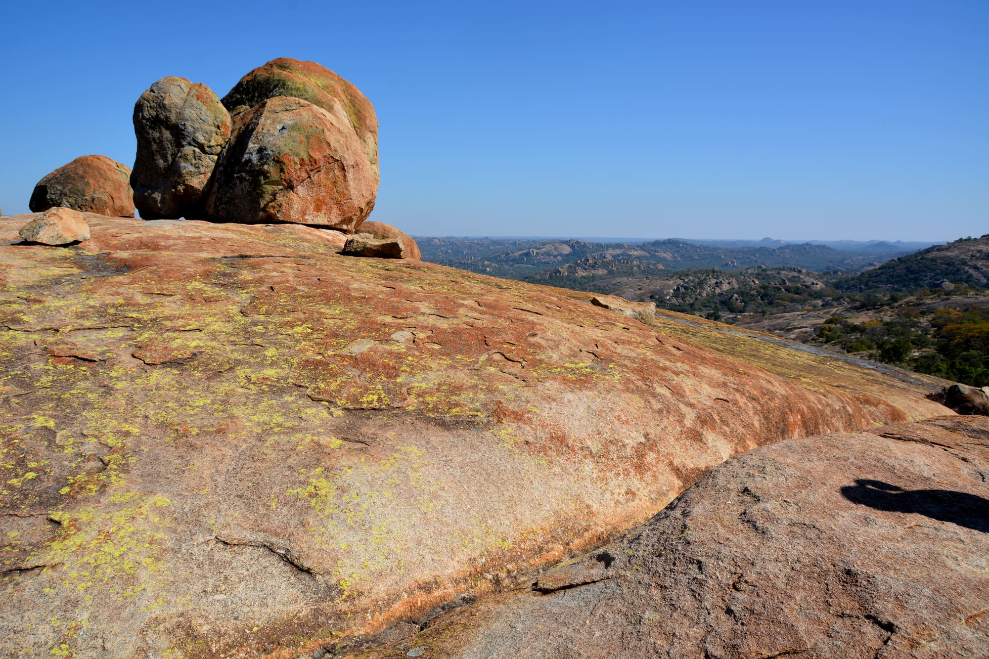
The granite of Matobo formed underground about 2,600 million years ago, as a vast bubble of rock that never reached the surface. Erosion did the rest. Running water stripped away the softer, chemically rotted rock around it and left the harder lumps behind. These come in two kinds: bornhardts, or dwalas, which are solid domes, and tors, or castle kopjes, which are heaps of weathered blocks balanced on one another. Where the rock flakes away in concave sheets it leaves overhangs and shelters, and people have used those for a roof and a canvas for a very long time.
The earliest human traces are hand axes and cleavers from Bambata, Pomongwe and Nswatugi, none found in a context that allows a secure date. The Middle Stone Age is better understood, and two of its stages are named after Bambata Cave and Tshangula. The massif may have stood empty in the driest part of the last glacial period, between about 25,000 and 15,000 years ago, and was occupied only on and off until the climate warmed about 13,000 years ago. Archaeologists then recognise a series of Later Stone Age phases, called Maleme, Pomongwe, Nswatugi and Amadzimba, each with its own tools and ornaments, including beads of ostrich eggshell.
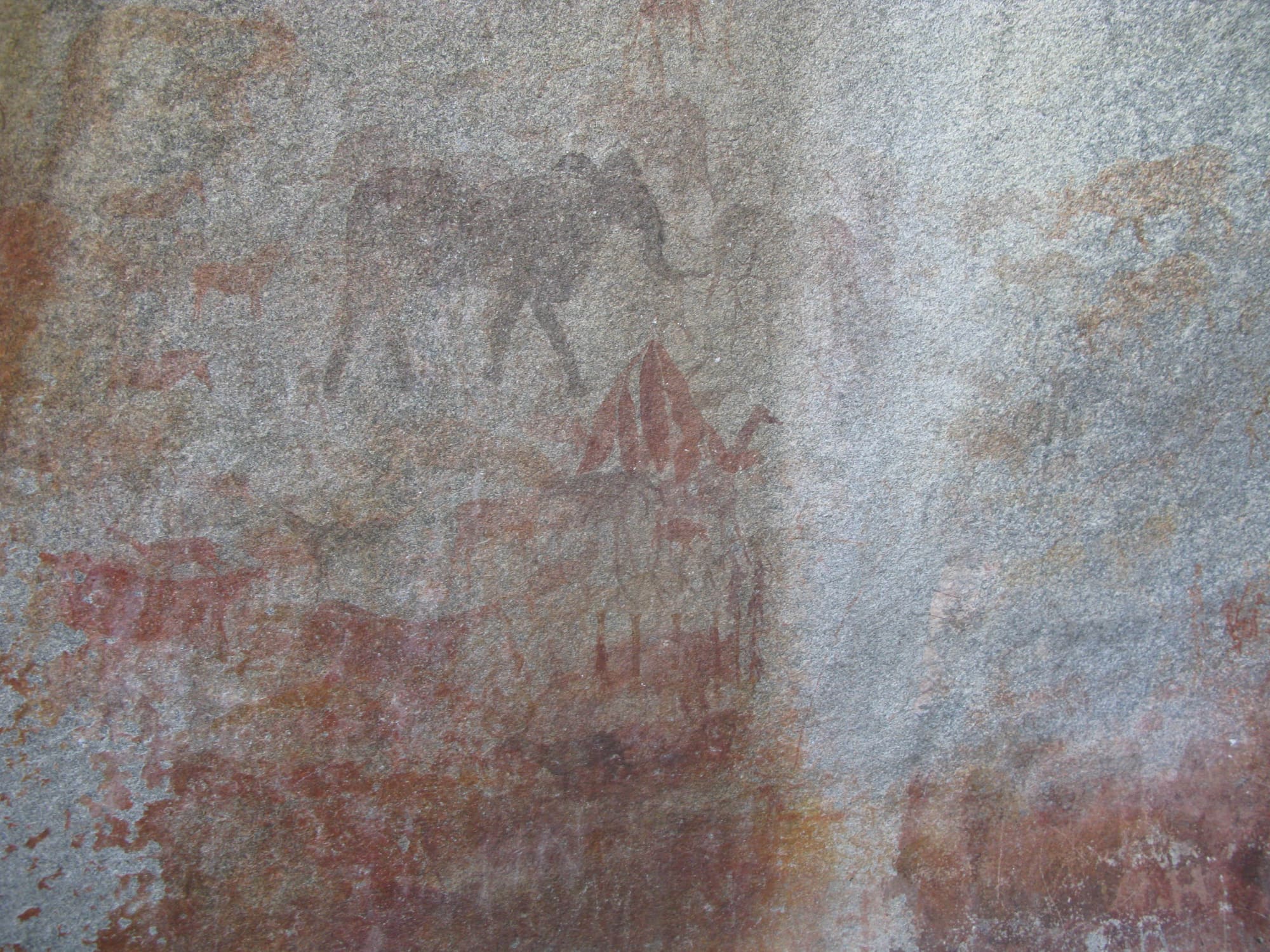
Painting belongs to the same long period. The MATOBART research team counts over 3,000 rock art sites, most made by hunter-gatherers between about 10,000 and 2,000 years ago. Nick Walker, who began re-investigating sites here in the 1970s, argued that painting started as early as 13,000 years ago at Pomongwe and the Cave of Bees. That is hard to prove, because the oldest painting in southern Africa to be dated directly is only about 5,500 years old, and testing the Matobo claim has been one aim of a French and Zimbabwean team since 2017.
The hills also produced one of the longer arguments in southern African archaeology. Bambata Cave, dug by Arnold and Jones in 1919 and by Armstrong in 1931, gave its name to the pottery of the first farming and herding communities in Zimbabwe, who moved south around 2,000 years ago. Yet pottery also turns up in some of the last hunter-gatherer layers at Bambata, and scholars still disagree on whether the foragers borrowed the idea or invented it themselves. Hunter-gatherers may have lived on in these hills well into historical times.
The name Matobo comes from a Kalanga word meaning 'bare stones', which King Mzilikazi popularised when his Ndebele followers settled here around 1832. They left a different pottery, clay grain bins and new shrines, among them his homestead, Mdhladhlandela, and his grave. The hills already belonged to an older religious tradition, the oracle of Mwari, and the two histories overlap.
In 1893 Rhodes's forces invaded and annexed the independent Ndebele state of Matabeleland, and in 1896 the Ndebele rose in the uprising known as Umvukela. After bloody but inconclusive skirmishes Rhodes concluded that force alone would not win the war. The first indaba, as the councils with Ndebele leaders were called, met on 21 August 1896, and the negotiations became one of the hills' landmark events. Rhodes chose the highest point of a long dome, Malindidzimu, as his burial place in 1898 and was buried there on 10 April 1902.
Matobo National Park was established in 1926 as the Rhodes Matopos National Park. By 1936 it had been decided that nobody else would be buried at Malindidzimu. The hills were inscribed in 2003, and the Committee asked Zimbabwe to set up an effective management committee that included all key stakeholders by 2004. Since 2017 the MATOBART project has re-opened trenches at Pomongwe, and a US-funded effort to rehabilitate the paintings there began in 2024.
03
Timeline
Key moments from the formation of the granite to the present-day research
The granite mass forms underground, later exposed by erosion
Rock painting may begin at Pomongwe and the Cave of Bees
Farming and herding communities arrive; Bambata gives its name to their pottery
Mzilikazi's Ndebele settle in the hills and popularise the name Matobo
Rhodes's forces invade and annex the independent Ndebele state of Matabeleland
The Umvukela uprising; the first indaba with Ndebele leaders meets on 21 August
Cecil Rhodes is buried at Malindidzimu on 10 April
Rhodes Matopos National Park is established
No further burials are allowed at Malindidzimu
Inscribed on the World Heritage List
The MATOBART project begins re-investigating Pomongwe and Bambata caves
A US-funded project to rehabilitate the paintings at Pomongwe Cave is launched
04
Why visit
Painted shelters, living shrines and a contested grave, all within one granite landscape
The first reason to come is the ground itself. Domes of bare granite rise out of dry woodland, boulders sit balanced on one another, and the narrow valleys between them hold dams, streams and a surprising number of animals. The rock explains the rest, because the same weathering that shaped the hills carved the shelters in which people lived and painted.
The paintings are the second reason. Pomongwe, Nswatugi, White Rhino and Silozwane are the painted sites that can be visited, and Pomongwe has a small museum. Recent recording at Pomongwe alone has turned up dozens of motifs that had not been published before, among them animals, human figures and a dancing scene. A trench there shows a finely layered Later Stone Age sequence above much older deposits, so the same shelter records how people lived long before and after the paint was applied.
The third is that the hills are a place of worship today. For centuries they have been associated with a regional oracle of Mwari, whose voice is said to be heard from the rocks. Shrines such as Njelele, Zhilo and Dula draw people from across Zimbabwe and other parts of southern Africa, and they are visited on the terms of those who look after them.
The fourth is the memory of the colonial period, set out on a single ridge. Rhodes chose his own grave here, and the question of whether it belongs in the hills is still argued. The park authority also states that Matobo has the world's densest population of leopards, which feed largely on hyrax, and the world's highest concentration of black eagles. Whatever the ranking, the rhinos and raptors add a natural interest to the heritage, and a visit can take in a rock painting, a shrine's neighbourhood and a rhino area within a day or two.
05
The setting
A granite massif at the edge of the lowveld, cut by near-parallel valleys
Matobo sits on the south-western edge of the Zimbabwean granite shield, at 1,200 to 1,500 metres above sea level. It lies close to the lowveld of the Limpopo-Shashe confluence, where Zimbabwe, Botswana and South Africa meet. Bulawayo, the country's second city, is about 35 kilometres to the north.
The hills form a series of ridges and domes separated by valleys that run north-north-west to south-south-east, because the rivers have followed natural joints in the rock. The batholith, the single mass of granite behind it all, is brownish gray and medium-grained, and it extends across about 2,050 square kilometres of the landscape and some of its surroundings. Soils are coarse and sandy, with small pockets of clay and organic matter, yet the variety of landforms gives a mosaic of habitats over short distances.
The climate is semi-arid, in the Zambezian savannah biome. Rain falls in summer, mostly between November and February, and average annual temperatures seldom exceed 35 °C. The Maleme, Mpopoma and Thuli rivers run through or rise in the hills and eventually join the Shashe and the Limpopo about 150 kilometres to the south, and many more streams run only in the wet months.
Matobo National Park, at about 424 square kilometres, is a modest fraction of the whole. It follows the valleys of the Thuli, Mtshelele, Maleme and Mpopoma rivers. Outside it the land is communal and farmed, so a drive across the landscape passes homesteads and grazing as often as wilderness. The park authority counts over 200 species of tree and over 100 of grass, and one research summary gives 88 mammal species and about 175 birds.
06
Key places
Five stops that cover the graves, the paintings and the park's rhino country
Malindidzimu (Rhodes's grave)
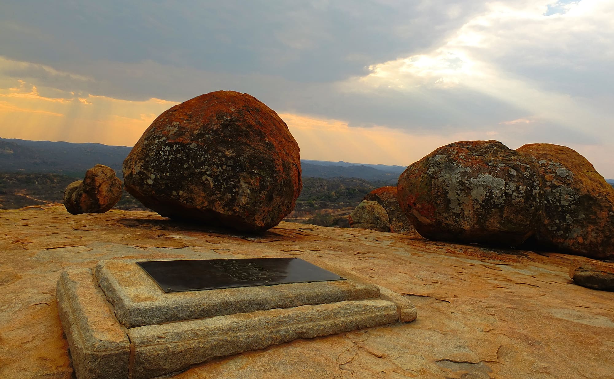
Malindidzimu is a long granite dome whose name is given as the dwelling place of benevolent spirits. Cecil Rhodes was buried here in 1902 in a tomb cut into the rock at the crest, alongside Sir Charles Patrick Coghlan and Leander Starr Jameson. A monument honours 35 soldiers killed in fighting with the Ndebele army, and a small gallery outlines Rhodes's life. Rhodes's own phrase was 'one of the views of the World', not the 'World's View' that stuck later. The burial is contested, and the Matobo Conservation Society says Banyubi chiefs were reportedly buried in clefts on the flanks. A reception area carries posters about those buried here.
Pomongwe Cave
Pomongwe is one of the most visited sites in the park, and it has a small site museum. Cooke dug here in 1960 and 1961, Walker after him, and a French and Zimbabwean team re-opened two trenches in 2018. Its walls show antelope and human figures, including a dancing scene, and researchers have found dozens of motifs that were not published before. The paint is fragile: several alteration processes have been identified, and a US-funded rehabilitation project began in 2024. Please read the responsible-travel notes before you touch anything.
Nswatugi Cave
Nswatugi is another of the painted sites that can be visited, and an important one for archaeologists. Jones excavated it in 1926 and 1933, and it gave its name to the Later Stone Age phase that ran from about 9,300 to 4,500 years ago, marked by tiny stone tools and elaborate beads of ostrich eggshell and shell. The MATOBART programme publishes a photograph of the painted wall in the shelter. Access details for the cave could not be confirmed at the time of writing, so check with the park before you set out.
White Rhino Shelter and Silozwane Cave
White Rhino Shelter and Silozwane are the other two painted sites that researchers list as open to visitors, which makes four in all with Pomongwe and Nswatugi. Cooke traced the paintings at Silozwane in the 20th century, and one of those tracings is still used to illustrate the site. Seeing more than one shelter is worthwhile, because with over 3,000 sites known the paintings are spread across the hills rather than gathered in one place. Access details could not be confirmed at the time of writing.
Maleme Dam and rest camp
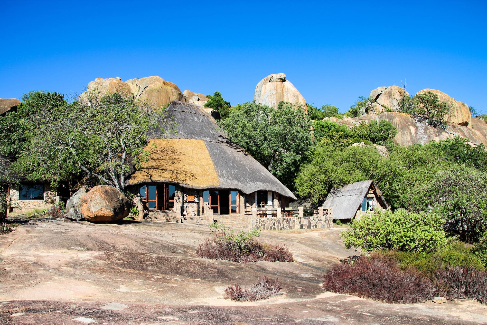
The tarred road from Bulawayo narrows to a single lane and ends at Maleme Dam and its rest camp, and the Maleme valley is one of the four that the park follows. The park authority describes the park as one of three intensive rhino protection zones in its estate, with both black and white rhinos. It cautions visitors to watch for rhinos with calves and for slippery rocks. Accommodation and camping are listed on the authority's website.
07
What to expect
Granite underfoot, a long hot season and a few rules about rhinos
Most people see Matobo from a car and then on foot, in short stretches over bare rock. The tarred road runs from Bulawayo to the park boundary and on, as a single lane, to Maleme Dam; the park authority describes the other roads as gravel, suitable for most vehicles, though some areas need a high-clearance four-wheel drive. Choose your vehicle and your route with that in mind.
The rock is the thing to plan around. The authority warns of slippery rocks, and a dome that looks like an easy scramble is still smooth granite, so shoes with a good grip matter more than the distance. Shade is whatever the boulders and trees provide. Average annual temperatures seldom exceed 35 °C, but that is an average, and the authority recommends light clothes, a sunhat and sunscreen from September to March. From April to August it advises warm clothing, especially at night.
Rain comes mostly between November and February. Heavy rain is likely to make the gravel roads slower, and many streams run only in the wet months.
Then there are the animals. The park is a rhino protection area, and the authority warns of rhinos with calves. It suggests earthy colours and no bright reds, yellows or greens, and it notes that leopards are present in unusual numbers, though that is a statement about density, not about your chances.
The authority tells visitors to bring binoculars, a camera, walking shoes, wildlife reference books or a phone app, and food for the whole stay, which is as good a guide to the shops as any. A first-aid kit, a torch, and tents if you intend to camp are also on its list.
Malindidzimu is among the most visited places in the hills and, for many people, the only one they see, so expect company there. The scale of the rock art may be the surprise: more than 3,000 sites, spread across the hills rather than gathered in one place. Opening hours could not be confirmed at the time of writing.
08
Photographs
More of the place, as it looks on the ground
09
Planning your visit
How to fit the paintings, the hill and the park into a visit
- Access
- Entry is through Matobo National Park, run by the Zimbabwe Parks and Wildlife Management Authority, with charges per person and per vehicle. Some areas of the park need a high-clearance four-wheel-drive vehicle. The shrines are entered only through their keepers.
- Accessibility
- Accessibility information is limited; contact the site before travelling. The park's roads are gravel beyond Maleme Dam, and the authority warns of slippery rocks.
- Entry
- About US$15 a day per international visitor and US$10 for a foreign-registered car or 4x4, from the 2023 Zimparks rate sheet; confirm current charges with Zimparks
- Services
- Basic servicesLimited facilities; bring water and food; accommodation some distance away
Practical details checked on
The sensible shape for a visit is one painted shelter, one memorial and one stretch of the park, rather than a dash through all of them. Malindidzimu and Pomongwe are the two most visited places, and Pomongwe has the small museum, so they make a fair first day. Travellers who want the hills at dawn or dusk can stay in the park: the authority lists accommodation and camping, and its advice to bring food applies to everyone who does.
The season matters. The wet months, November to February, bring heavy rain on gravel roads, and the dry months are cooler, with cold nights from April to August. Light clothes and sun protection are advised from September to March. Which months are best for visitors could not be confirmed, so the best months are left empty.
The shrines are a different matter. Njelele, Zhilo and Dula are places of worship, not attractions, and the keepers of Njelele control who may enter and when. Do not plan to visit them as a sightseer.
Whether a guide is required, how booking works and the park's opening hours could not be confirmed at the time of writing. Zimparks lists a telephone number, +263 242 707625, and an email address, info@zimparks.org.zw, on its Matobo page; contact them before you travel.
On-site services
The park authority points visitors to accommodation and camping within the park, and the tarred road runs as far as Maleme Dam and its rest camp. It advises bringing food for the whole stay, a first-aid kit and a torch. A reception area at Malindidzimu carries information posters, and a small museum stands at Pomongwe Cave. Toilets, water points, guides and mobile signal could not be confirmed at the time of writing.
10
Getting here
From Bulawayo, a short drive south on a tarred road that turns to gravel
The main gateway is Bulawayo, Zimbabwe's second city, and the park authority tells air travellers to land at Bulawayo International Airport and continue by road. The hills begin about 35 kilometres south of the city.
From the centre of Bulawayo you take Robert Mugabe Way, which becomes the Matopos Road and runs south for 30 kilometres to the park boundary. This stretch is a two-lane tarred road. Beyond the boundary the tar continues as a single lane to Maleme Dam and its rest camp, and the remaining roads in the park are gravel. The authority says they suit most vehicles, but that some areas can be reached only with a high-clearance four-wheel drive. Before the boundary the road crosses the Rhodes Matopos Estate, where traces of Rhodes's open-air summerhouse can still be seen.
Journey times from the airport or the city centre, typical taxi fares, public transport to the park, hire cars and guided transfers could not be confirmed at the time of writing. Nor could border arrangements for travellers coming from Botswana or South Africa, although the hills lie not far from the point where the three countries meet. Visa rules depend on nationality, so check the Zimbabwean government's immigration pages rather than relying on a summary here.
Vehicles pay an entry fee on top of the per-person charge, and the 2023 Zimparks rate sheet sets it by vehicle type and by whether the vehicle is locally or foreign registered. The same sheet says overland trucks must keep to defined routes in Matobo. A private car or a hired vehicle with a driver is therefore the practical choice, since the hills are a spread-out landscape rather than a single site with one gate and a car park.
Once inside the park the distances are short on the map and slow on the ground, because most of the roads are gravel. Plan the day around the places you actually want to see rather than a circuit of the whole park, and keep in mind that the shrines are not reached by any visitor road: they are entered through their keepers, as the section on local culture explains.
The park authority gives a telephone number, +263 242 707625, and an email address, info@zimparks.org.zw, on its Matobo page. Wet-season conditions on the gravel roads can change quickly, so ask before you set out if the rains have been heavy.
11
Local culture
The names, shrines and settlements of several peoples overlap in these hills
No single people owns the story of these hills. The name Matobo comes from a Kalanga word meaning 'bare stones', Mzilikazi's Ndebele settled here around 1832, and the oracle of Mwari links communities from across Zimbabwe and other parts of southern Africa to the landscape, according to the archaeologists Ancila Nhamo and Camille Bourdier. The Banyubi are said to have buried some of their chiefs in clefts on the flank of Malindidzimu, though nobody now recalls their names.
Shrines such as Njelele, Zhilo and Dula are revered to the present. At Njelele, the keeper in 2012, Solifa Ncube, whom people call Khulu Thobela, told the Chronicle that worshippers go there through the shrine's keepers and at set times. The journalist and cultural activist Saul Gwakuba Ndlovu said people ask Mwali for help during epidemics, outbreaks of locusts, and when a couple or livestock cannot breed. He added that it is not permissible to go to the shrine directly, without being led by the keeper responsible for it. In 2012 local people complained that groups, including war veterans, had visited without the approval of the traditional leadership.
On the communal land around the park, families keep cattle and goats, and the Ndebele left clay grain bins and pottery that can be recognised as theirs. The words indaba, a council, and bayete, the royal salute, are still part of how the hills' history is told.
Visitors should treat the shrines as working places of worship. The parts of this guide that describe what is said about them come from published accounts, and they leave out what happens inside.
12
Mythology
The voice from the rock, and the hill of benevolent spirits
The best-known story belongs to the oracle of Mwari, the high god, who is also called Mlimo. According to the archaeologists who have written about the hills, this god's voice is said to be heard from the rocks, in a landscape of deep caves, sacred forests, trees and pools.
At Njelele, a villager named Joyce Moyo told the Chronicle in 2012 that the shrine was once where elders reported droughts, lightning and disease, and apologised for the wrongs of their society. She said that a voice used to come from the Njelele rock whenever spirit mediums presented their concerns, and that it has since fallen quiet because of the disrespect shown to the place. It is taboo, the same article says, to point a finger at the shrine.
Saul Gwakuba Ndlovu, quoted in the same piece, gives the shrines a line of descent. He said that the first lay at Lutombo Gwabanyayi, when the Venda people entered the land of the Kalanga following the Thuli River, and that other shrines followed the river northwards, among them Chizeze, Mbudzi and Mavulamatjena, now called White Waters, before Njelele. This is his account, and other oral traditions exist.
Malindidzimu has its own name. The Matobo Conservation Society translates it as the dwelling place of benevolent spirits, and says it is told that the Banyubi buried their chiefs in its clefts. The society thinks it unlikely that Rhodes, who chose the hill for his own grave, knew of those burials.
Some of what is said about these places is not shared outside the communities concerned. What is written here is only what has been published.
13
Anecdotes
A misquoted view, a coffin hauled up by oxen and a great many leopards
Malindidzimu is often called World's View, and it is usually said that Cecil Rhodes gave it that name. The Matobo Conservation Society says what Rhodes actually said was 'I call this one of the views of the World', and that the better-known form is a later misattribution. A small point, perhaps, but it is the sort of correction that sticks to a place once it has been printed on enough postcards.
Rhodes died in 1902 and was brought north by steam train, which stopped at every small town so that local people could pay their respects. In Bulawayo the body lay in the Drill Hall, then at his farm at the edge of the hills, in his favourite open-air summerhouse, whose traces can still be seen on the estate. The grave was cut into the rock and a new road was opened to the hill. A team of black oxen, chosen as a nod to Ndebele custom, hauled the coffin on two joined gun carriages, and the burial took place on 10 April.
Most of Bulawayo's white residents crowded between the boulders. On the flat ground to the west a large group of Ndebele men stood outside them, and when the service ended they cried out together 'bayete', the Ndebele royal salute. The society calls it a mark of respect. After the burial Rhodes's brother Frank handed the grave site to the Ndebele nation, though in time the Rhodesian state took that authority away. In 1936 it was decided that no one else would be buried there.
The park has stories of a quieter kind. The park authority states that Matobo holds the world's densest population of leopards, because hyrax, a small rock-dwelling mammal, make up half of their diet, and that it has the highest concentration of black eagles anywhere. Visitors who find a hyrax on a sunny boulder may see a leopard's lunch, and probably won't mention it to the hyrax.
14
Challenges
Fragile paint, a contested grave and the question of who manages a shared landscape
The hills are not on the List of World Heritage in Danger, the register the Committee uses for places whose values are under serious threat. Recent Committee conservation papers could not be read for this guide, so the concerns below come from researchers, the park authority and the press. At inscription in 2003 the Committee asked Zimbabwe to set up an effective management committee that included all key stakeholders and to complete a management system suited to the property. The pressures that follow are mostly those of a landscape with many users: paintings that weather, memorials that people dispute, and shrines whose keepers want to control who visits.
- Researchers at Pomongwe Cave have identified several alteration processes that affect the paintings and have made recommendations for preserving them. A US$125,000 rehabilitation project, launched in 2024, is working on the cave with local and international partners.
- The burial of Rhodes on Malindidzimu remains highly controversial, according to the Matobo Conservation Society. Calls for his remains to be removed have been made since 1961, and the society thinks consensus unlikely.
- Shrines such as Njelele have been the subject of disputes over who may visit. In 2012 local leaders complained about unsanctioned visits, and the keepers said such visits had damaged the shrine's standing.
- Dating and sequencing the rock art remain open questions, as they are across southern Africa, according to the researchers. The MATOBART project has been working on them since 2017.
15
Travelling responsibly
Small habits that suit paintings, shrines and animals with calves
- Please do not touch, chalk or wet the paintings. Researchers have already identified several processes that are altering the paint at Pomongwe.
- Do not point at Njelele or approach the shrines without their keepers. Pointing is taboo, and the keepers decide who may enter.
- Treat Malindidzimu quietly, as a burial ground that people see in different ways, and keep to the paths the park provides.
- Keep your distance from rhinos, particularly females with calves, which the park authority specifically warns about. Never approach on foot.
- Wear earthy colours rather than bright reds, yellows or greens, as the park authority advises.
- Bring your own food and take your rubbish away with you; the park authority advises visitors to carry food for the whole stay.
16
In the news
Recent reporting, summarised
· CITE
Matobo san rock art preservation project reaches major milestoneA US-funded project to restore San rock art at Pomongwe Cave screened a documentary on its work, a milestone in a US$125,000 programme.
17
Frequently asked questions
The questions travellers ask most
Is Matobo Hills the same as Matopos?
Yes. Matobo is the form closest to the local pronunciation, and it comes from a Kalanga word for bare stones. Colonial settlers turned it into Matopo, Matopo Hills and Matopos, and older maps and books still use those.
Can you visit the shrines?
Not as an ordinary sightseer. Njelele is a working place of worship, and people reach it through its keepers, who decide who may enter and when. If you have a genuine reason to ask, approach the keepers through a local contact, and accept a refusal.
Is Rhodes's grave open to visitors?
Yes, it is one of the most visited places in the hills, and the park authority mentions a small gallery on his life at the site. The grave is contested, and the hill is regarded by some people as sacred.
How old are the paintings?
Most are thought to be between about 10,000 and 2,000 years old, and they were made largely by hunter-gatherers. Some researchers argue that painting began here as early as 13,000 years ago, but the oldest painting in southern Africa dated directly is about 5,500 years old.
Can you see rhinos?
The park holds black and white rhinos and is one of three intensive rhino protection zones in the park authority's estate. Sightings cannot be promised, and the authority warns visitors to take care around rhinos with calves.
Do I need a guide?
The park authority pages that could be read do not say that one is compulsory, but they do not rule it out either. For the painted shelters, ask at the park about guides and access before you go. At the shrines, access runs through the keepers.
18
Location
A granite island south of Bulawayo, drained by streams that end in the Limpopo
Bulawayo, about 35 kilometres to the north, is the only large town in reach and the place to find supplies, rooms and transport before you head south. The hills themselves begin where the Matopos Road meets the park boundary, 30 kilometres from the city centre.
Inside the park the road runs towards Maleme Dam and its rest camp in the Maleme valley, one of four valleys, with the Thuli, Mtshelele and Mpopoma, that the park follows. The Thuli, Maleme and Mpopoma rivers rise in or run through the hills, and the water eventually joins the Shashe and the Limpopo about 150 kilometres to the south.
The hills overlook the lowveld at the point where Zimbabwe, Botswana and South Africa meet. That is not close, but it explains the dry, bushy landscape on the southern side. Outside the park boundary the land is communal and farmed, so a map of the area shows villages and homesteads scattered between the domes, not an empty wilderness.
Matobo Hills is about 45 km south of Bulawayo. The nearest other World Heritage site is Khami Ruins National Monument, about 45 km away.
Nearest towns and cities
- Bulawayo · about 699,000 peopleabout 45 km north
- Francistown · about 90,000 peopleabout 130 km south-west
- Zvishavane · about 36,000 peopleabout 160 km east
- Gweru · about 183,000 peopleabout 180 km north-east
- Kwekwe · about 99,000 peopleabout 230 km north-east
- Beitbridge · about 26,000 peopleabout 240 km south-east
19
Around the site
Places worth the detour, and the nearest World Heritage neighbours
Nearby World Heritage sites
ZimbabweCultural46 km away
South AfricaCultural206 km away
ZimbabweCultural255 km away
Zambia, ZimbabweNatural403 km away
ZimbabweNatural535 km away
20
Further resources
Books, links and people who know the ground
Books
- Voices from the Rocks: Nature, Culture, and History in the Matopos Hills of ZimbabweTerence Ranger, 1999
- The Matobo Hills: Zimbabwe's Sacred LandscapeRobert S. Burrett, Moira Fitzpatrick and Julia Duprée, 2016
- The Painted HillsNicholas Walker, 1996
- The Painted CavesPeter Garlake, 1987
Links
The official record
- World Heritage Centre page for this sitewhc.unesco.org
Trip reports
No one has written up a visit to Matobo Hills yet. If you have been, we would like to hear how it went.
Been here? Share a trip reportGuest reports are credited and edited with you before they appear.
Suggest a correction or additionEvery message is read by an editor.
Last reviewed