Viñales Valley
Also known as Valle de Viñales
Limestone towers rise over tobacco fields still ploughed by oxen in western Cuba.
01
Introduction
A farming valley with a ceiling of rock, and a hard time to be visiting it
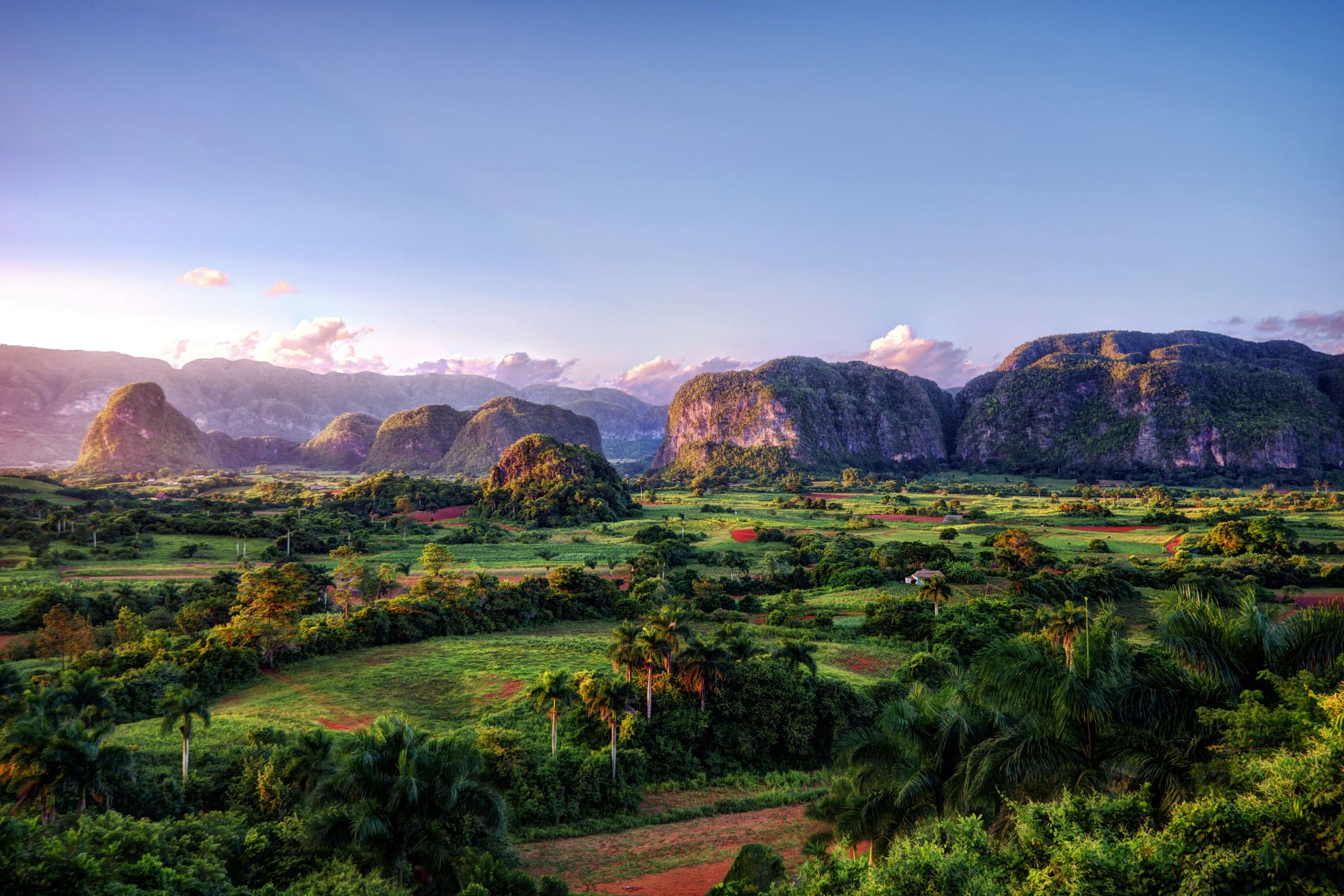
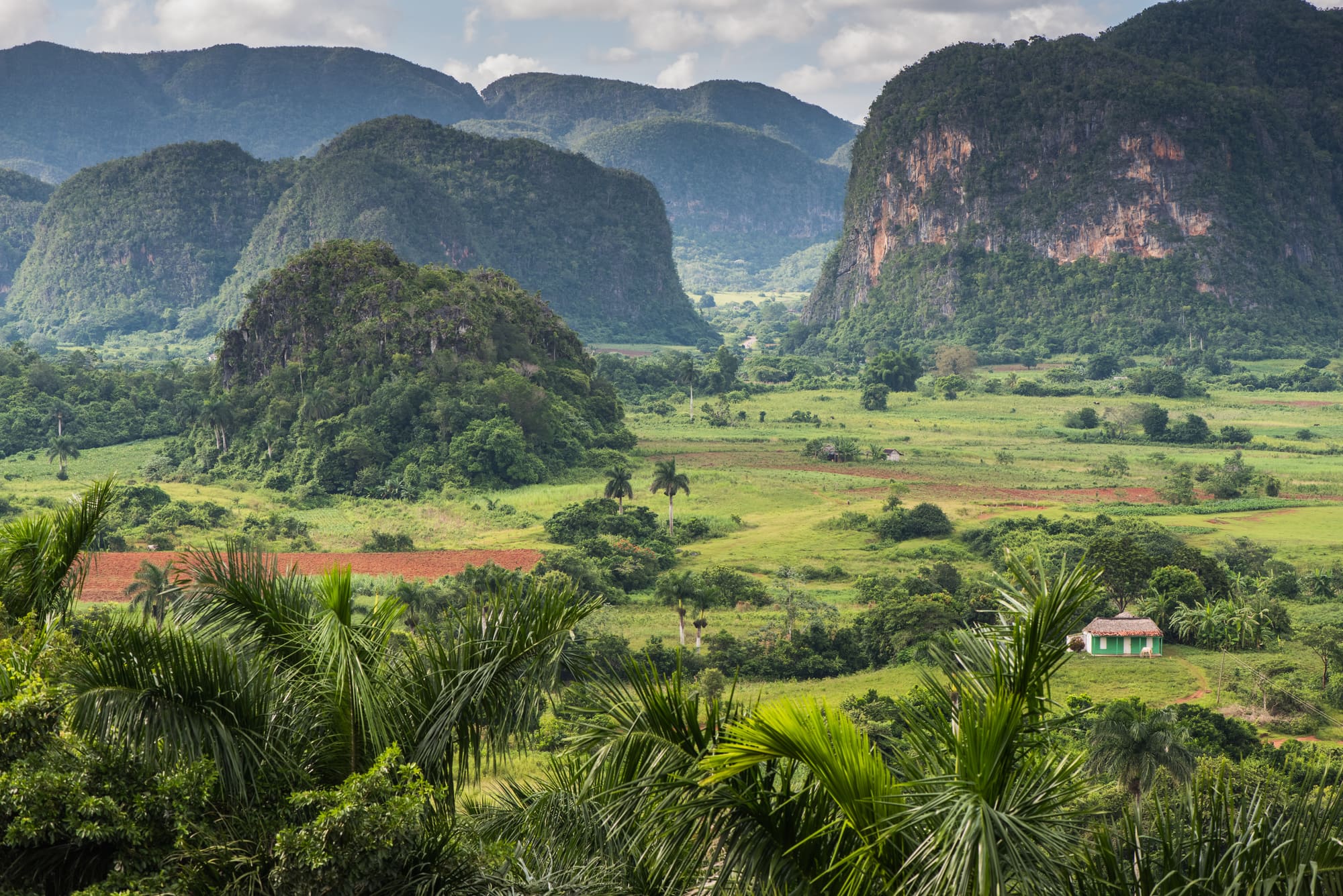
Viñales Valley is a flat-floored basin in the Sierra de los Órganos, in Pinar del Río province at the western end of Cuba. It covers around 132 square kilometres. Out of that floor rise the mogotes: steep, rounded limestone hills, the tallest about 300 metres high. Between them sit small farms, a scatter of hamlets and one main village, Viñales, where most of the valley's people live.
The farming is why it's on the World Heritage List. The World Heritage Committee inscribed the valley in 1999 (inscribed just means added to the List) and called it an outstanding karst landscape, karst being limestone country carved by water. Its point was that traditional agriculture, tobacco above all, had carried on here for centuries. The caves are a bonus. So are the hills.
It's a working place, not a museum. Growers still use oxen, drying barns still hold the leaf, and a bad year hurts the families who farm it. Right now it's a difficult place to reach. Fuel shortages and blackouts have hit Cuba hard, and the British government advises against all but essential travel there. Anyone planning a trip should read Getting here before anything else.
02
History
Cattle, tobacco, runaways and a cliff painted by people on ropes
The valley sits in the Sierra de los Órganos, part of the Guaniguanico range. One guidebook dates the limestone to the Jurassic, about 160 million years ago. Water did the rest. Over millions of years, rain and underground streams ate into the rock, and what stayed standing became the mogotes. Geologists call that kind of landscape karst. It comes with caves and sinkholes built in.
People got here long before the Spanish. The Slave Route Project's entry on the valley says nomadic Aboriginal communities lived here first, and it lists 47 known archaeological sites. Nineteen belong to pre-Hispanic communities. Cueva del Indio takes its name from them: remains and cave paintings turned up inside, and one guidebook links the cave to the Guanahatabey people. The cave itself was found again in 1920 by a local farmer, Juan Díaz.
Spanish settlers used the valley for cattle first. Ranching was the main economic activity through the 1600s and 1700s. Tobacco planters began arriving around 1670, and the crop took over. By 1840 the valley held more than 3,000 vegas, the Cuban word for a tobacco farm.
Plantations meant slavery, and slavery meant escape. Runaway enslaved people, known as maroons (cimarrones in Spanish), built communities in the valley's caves and rock shelters. Twenty-eight of the 47 known archaeological sites date from 19th-century maroons. The same entry says the valley's customs in religion, language, songs and dances blend Aboriginal, African and Spanish roots. Nobody has untangled which strand is which, and probably nobody should.
Tobacco has a long afterlife here. The Caribbean Beat report from 2023 describes growers who sell most of what they grow to the state, then watch it sorted, graded and rolled into cigars somewhere else. The part of the story that visitors see is the growing, and that has barely changed in how it looks.
Viñales village came late. It was founded in the 1870s, as tobacco spread, though sources give 1875, 1878 and 1879 and none of the sources read for this guide settles it. After the Revolution, large plantations were broken up and small plots went to the farmers who had worked them, according to a 2023 magazine report. That's the pattern you still see: small family vegas under the cliffs.
Then, around 1959, came the odd bit. The painter and scientist Leovigildo González Morillo, who ran the cartography department at the Cuban Academy of Sciences and had studied Diego Rivera's work, set out to paint the history of life on a mogote called Pita, in the Dos Hermanas valley. Some sources date the design to 1961. The rock was cleaned and drained first, so erosion wouldn't strip the paint. Then 18 to 20 local residents, hanging from cords, spent four or five years covering a face 120 metres high and 160 metres wide with snails, dinosaurs, sea creatures and humans.
The Committee inscribed the valley on 29 November 1999, at its 23rd session, and the same year the valley received the Melina Mercouri Prize for cultural landscapes. Tourism followed the inscription, slowly at first. By the early 2000s rock climbers had found the limestone, and new routes brought more visitors. Then two years of COVID restrictions and the 2022 hurricane hit hard, and when a magazine writer visited in January 2023, most hurricane damage had been repaired but visitor numbers were still very low. Since then the story has mostly been weather and money. Hurricane Ian crossed Pinar del Río province in September 2022 and wrecked tobacco barns and crops. In February 2026, fuel shortages helped push Cuba to postpone its annual cigar festival, and tourism fell away.
03
Timeline
From pre-Hispanic caves to the fuel crisis of 2026
Aboriginal communities live in the valley and use its caves
Cattle ranching is the main economic activity
Tobacco planters begin to arrive in the valley
More than 3,000 tobacco farms, called vegas, are recorded here
Viñales village is founded, with sources giving 1875, 1878 or 1879
A local farmer, Juan Díaz, finds Cueva del Indio again
Work begins on the Mural de la Prehistoria, which takes four or five years
Inscribed on the World Heritage List and given the Melina Mercouri Prize
Hurricane Ian destroys tobacco barns and crops across Pinar del Río province
Fuel shortages hit tourism and postpone Cuba's annual cigar festival
04
Why visit
Where the farm, the cliff and the cave all sit within walking distance
The first thing is the shape of the place. The valley floor is flat, and the mogotes go straight up from it, some 300 metres high, with nothing sloping in between. Few landscapes in the Caribbean look like this. The classic view is across the floor towards the twin hills of Dos Hermanas, the most photographed spot in the valley. The hills are also climbed: rock climbing and hiking have drawn a steady stream of visitors since the early 2000s, and new routes on the limestone kept being found.
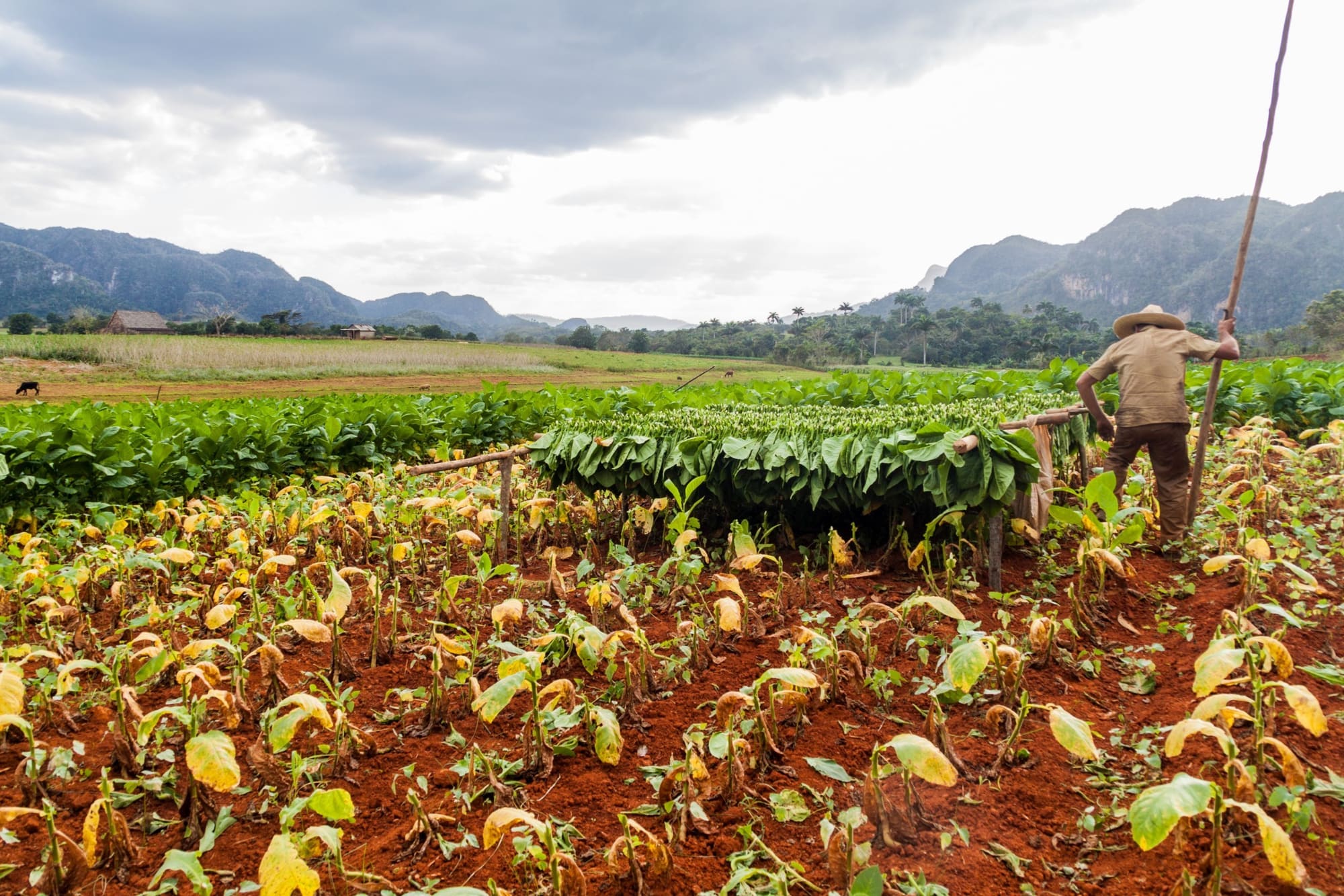
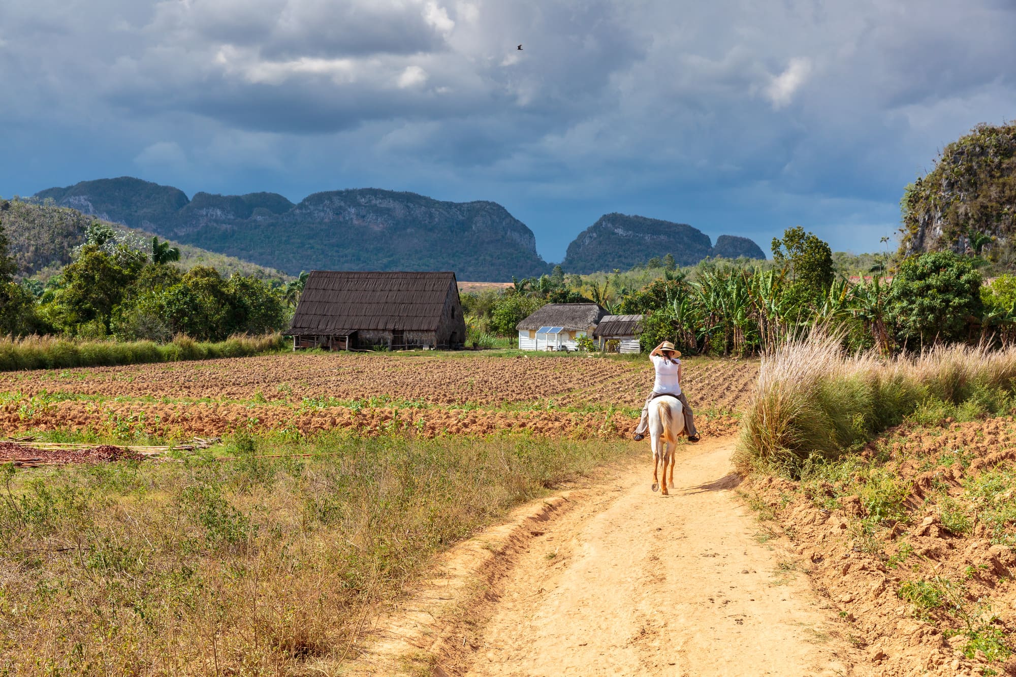
Then there's what happens at ground level. Tobacco grows between the hills in small family plots, and growers have kept to oxen and hand work instead of tractors. A visit to a farm shows the whole chain: planting, the drying barn, the leaf hung out to cure. Nothing is staged for you, because the work was already going on. Visitors can also tour a local cigar workshop, where much of the work is still done by hand.
The valley also keeps older stories under the surface. Its caves held Aboriginal communities and, later, people who escaped the plantations. A visitor can walk into one of the same caves and take a short boat ride along an underground river. The history is physical here, and you can touch the rock it happened in. The valley is also home to some small, unusual wildlife, including the bee hummingbird and the Cuban trogon, according to a reference entry.
And then there's the mural. It was painted by local residents hanging from ropes over a period of four or five years, and it covers a cliff 120 metres high. Not everyone is convinced: one guidebook calls it the most contrived thing in the valley. It's still a very big thing to paint with a brush.
05
The setting
A flat-floored basin in western Cuba, closed in by limestone hills
Viñales Valley lies in the Sierra de los Órganos, in the Guaniguanico range at the western end of Cuba. The protected area covers around 132 square kilometres. Havana is about 202 kilometres away by road, and Pinar del Río city, the provincial capital, is about 25 kilometres south of the village.
Geologists call it a karstic depression: a wide, flat-bottomed basin in limestone country. The mogotes stand on the floor, up to 300 metres tall, and the surrounding hills are the same limestone, so the edges of the basin are steep rather than gradual. Caves open in their lower slopes, and underground rivers run through some of them. Cueva del Indio is one. The Gran Caverna de Santo Tomás, about 17 kilometres west of the village, has around 46 kilometres of galleries, according to a guidebook.
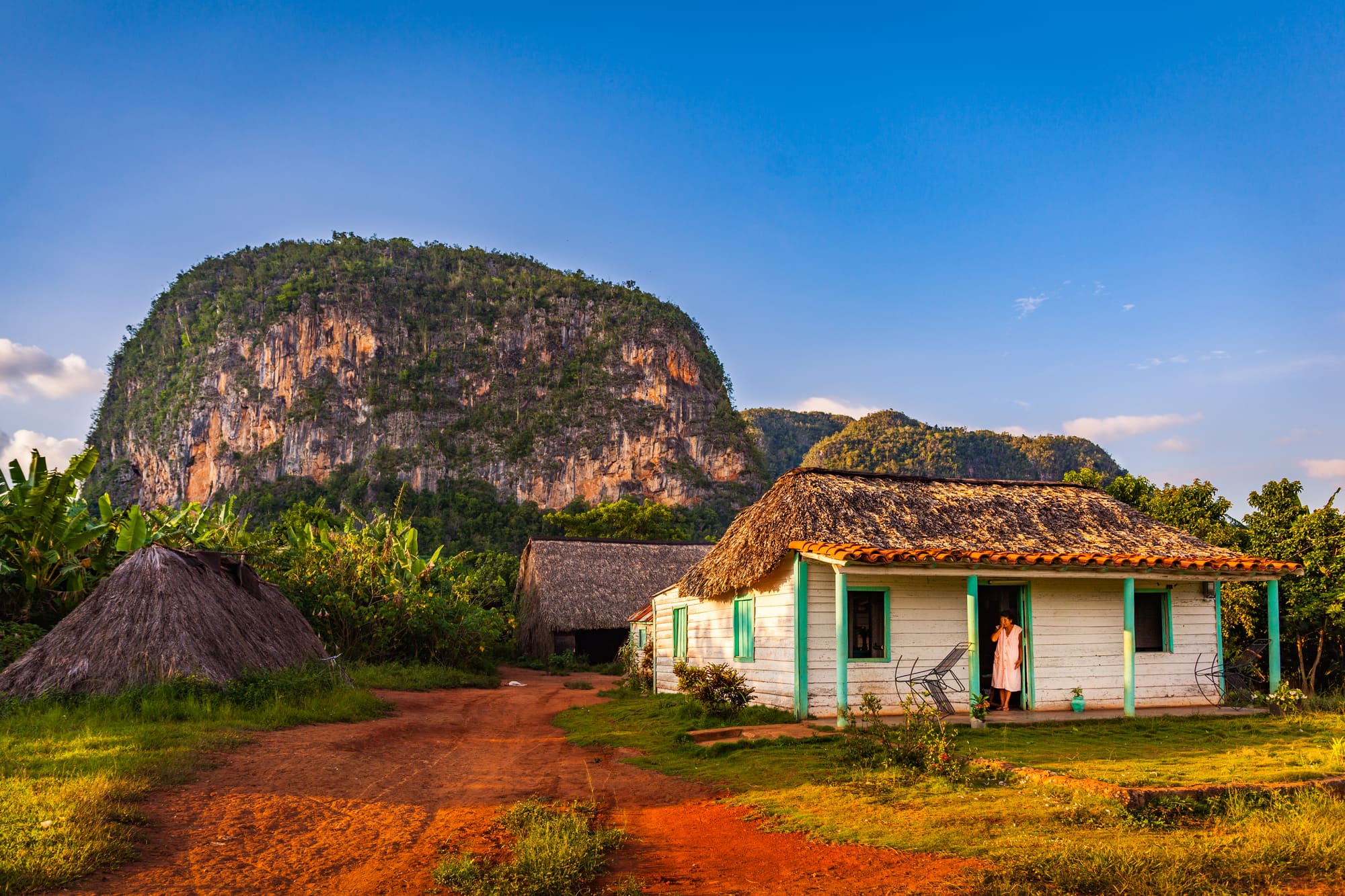
Most people live in Viñales village, on the valley floor. The rest of the valley is farms, scattered houses and curing barns.
The climate is tropical. The dry season runs roughly from November to April, and the rains arrive from May to October. From about June to October it usually rains in the afternoons, and mosquitoes get worse. Hurricane risk is highest in late summer and autumn. Sources differ on the exact months.
06
Key places
Six stops in a valley where the farmland is as much the sight as the hills
Viñales village
The village is where most of the valley's people live and where most visitors stay. Single-storey houses, many of them painted and many now casas particulares (private homes that rent rooms), line a short main street running off a central square with a small church. A craft market on the main street sells hand-carved wooden hummingbirds, salad servers and straw hats. According to a January 2023 report, the street closed to traffic on Saturday nights for an open-air party called Noches Viñaleras. Whether that is still happening is worth asking your host.
Valle de Dos Hermanas and the Mural de la Prehistoria
The twin mogotes of Dos Hermanas ("two sisters") are the most photographed hills in the valley. On the face of one, called Pita, is the Mural de la Prehistoria, painted by local residents on ropes over four or five years and 120 metres high by 160 wide. It shows snails, dinosaurs, sea creatures and humans, standing in for the stages of life on Earth. A guidebook calls the mural the most contrived sight in the valley, and you may agree.
Cueva del Indio
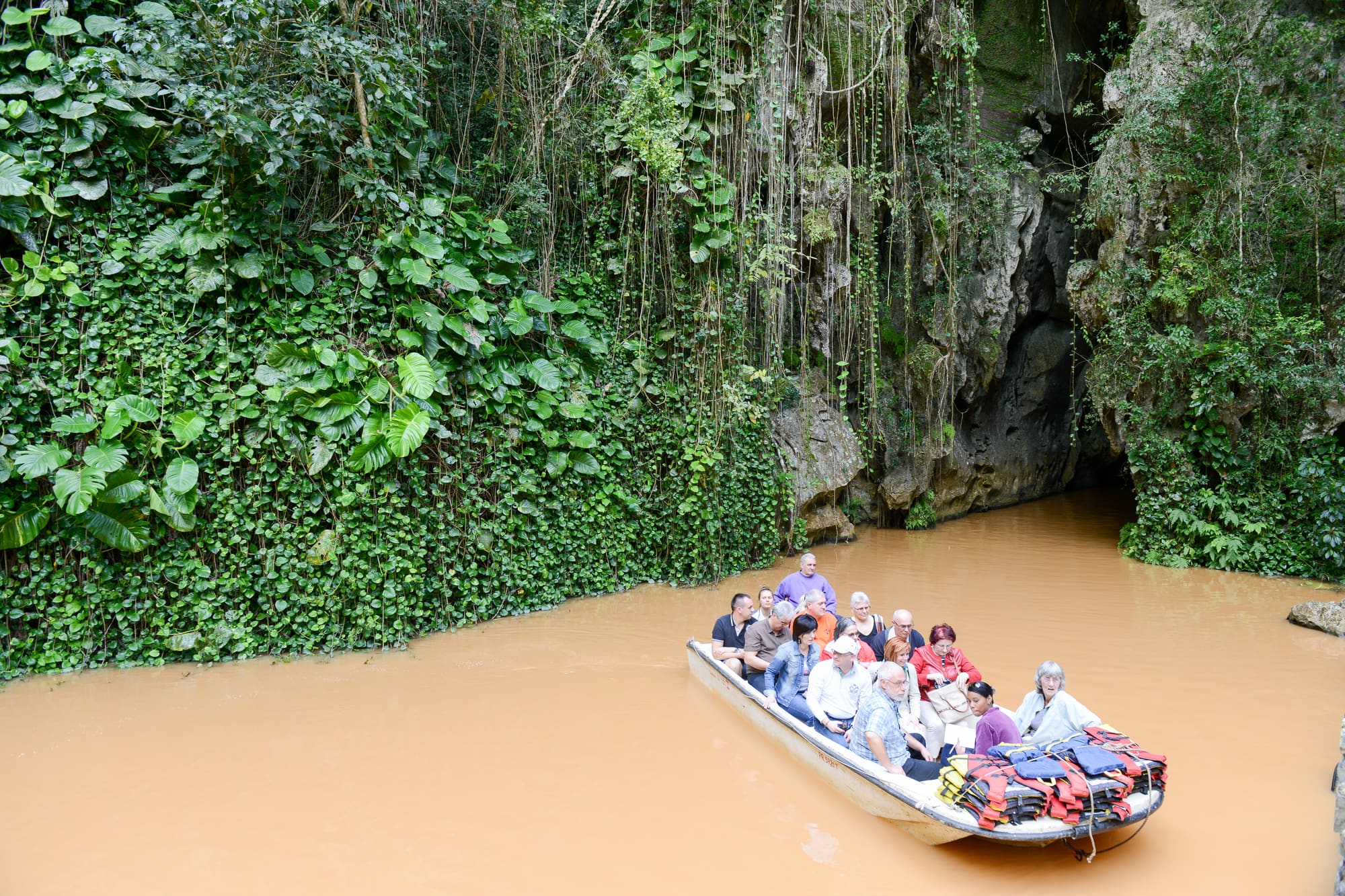
About 8 kilometres north of the village, this cave takes its name from the pre-Columbian people whose remains and paintings were found inside. The visit starts with a walk of 250 to 300 metres, and then a flat-bottomed motor boat carries visitors for roughly 10 minutes through about 400 metres of cave, past a cascade. The motor is loud and the boat doesn't stop, so explanations are hard to hear. Thousands of bats are reported to leave the cave at night. A 2020 page says it gets crowded in peak season and suggests early mornings, though the crisis may have thinned the crowds.
The Jazmines viewing platform
The standard panorama of the valley is from the viewing platform at Hotel Jazmines, just off the road from Pinar del Río, on the way into the valley. From the hillside you see the flat floor, the field boundaries and the lines of mogotes in the distance. It's a roadside stop, and the platform belongs to a hotel. Whether it is open to non-guests at the moment could not be confirmed.
Tobacco farms and curing barns
The valley's reason for being on the List is out in the fields. Small family farms grow tobacco between the hills, and the leaf is hung to dry in curing barns, called secadoras. Visits and horseback tours through the fields are common, according to a 2023 report. Growers there said they use oxen rather than tractors, and that the state buys about 90% of each crop at a fixed price. Hurricane Ian damaged tobacco barns across the province in 2022. Ask a grower what the year has been like; the answer is usually the most useful part of the visit.
San Vicente, Cueva de San Miguel and El Palenque de los Cimarrones
The San Vicente area holds two caves. Cueva de San Miguel is one; El Palenque de los Cimarrones is a small cave that leads to a simple encampment, named for the maroons (runaway enslaved people) who sheltered in the valley's caves. It is now mainly a lunch stop for tour groups, according to a guidebook. The story is better than the restaurant, so read up first. Valle Ancón, on the northern edge of San Vicente, is less visited and harder to explore.
07
What to expect
Tobacco smoke, loud boats, afternoon rain and a lot of walking in the sun
Viñales isn't one monument. It's a valley, and you'll move around it in pieces: a walk through fields, a short boat ride, a hillside viewpoint. The main stops are several kilometres apart.
The village itself is small, a main street and a square, with plenty of private rooms and a few places to eat. That's the practical centre of any visit, and most days start and end there. Wi-Fi is thin; a magazine writer in 2023 found the only hotel was the main hotspot. Power cuts are now routine across Cuba, according to the British government, so expect dark evenings and a patchy supply. Bring a torch and a charged power bank. And keep some cash in small amounts, since card payments may not work at all.
In the caves, the Cueva del Indio walk is short and mostly concrete-floored, and then you get in a boat. The motor is loud. The boat doesn't stop, and you won't catch much of the guide's commentary over it. Thousands of bats are reported to leave the cave at night, so the exit is best at dusk, if you can arrange it.
On the farms, the sun is the problem. There is not much shade between the hills, and the valley floor holds the heat. From about June to October it usually rains in the afternoons, so mornings are the time to be outdoors. Mosquitoes are worse in that season too. Bring a hat and repellent, and water.
Crowds are hard to predict at the moment. A few years ago, December to March was the busy stretch, but reports from early 2026 say tourists have stopped coming. Fewer people means more room, and also fewer open restaurants and tour operators. And don't expect to pay by international card. The British government says Visa and Mastercard no longer work in Cuba, so bring cash for the whole stay.
08
Photographs
More of the place, as it looks on the ground
09
Planning your visit
Dry-season weather, a cash-only trip and a travel warning to read first
Best months
- January: best
- February: best
- March: best
- April: best
- May
- June
- July
- August
- September
- October
- November: best
- December: best
November to April
- Access
- Could not be confirmed at the time of writing.
- Accessibility
- Accessibility information is limited; contact the site before travelling.
- Entry
- Could not be confirmed at the time of writing.
Practical details checked on
Start with the advice. The British Foreign, Commonwealth and Development Office (FCDO) advises against all but essential travel to Cuba, in an update dated 25 September 2026. It reports that the national grid has collapsed several times and may do so again, that fuel is rationed, and that the authorities say all international airports have no aviation fuel. Several airlines have suspended flights. Read the full advice, and your own government's, before you book anything. This guide can't say whether a trip is wise.
If you do go, allow a full day at the least. The caves, the mural and a farm visit fill it easily, and a second day lets you walk the fields without a schedule. That is the writer's suggestion rather than an official figure.
Weather decides the season. The dry months, roughly November to April, are the comfortable ones. From May to October the rains come, afternoons are wet from about June, and hurricane risk peaks in late summer and autumn. Hurricane Ian devastated Pinar del Río province in September 2022, so watch forecasts closely in the wet season.
Stay in the village if you can: private rooms are the norm, and the valley is a short ride away. Local guides can add a lot on the farms and caves. Permit or timed-entry rules could not be confirmed, so ask your host.
On-site services
Could not be confirmed at the time of writing.
10
Getting here
Two hundred kilometres from Havana, by bus or car, with fuel the weak link
Check the warning first. The FCDO's Cuba advice, updated 25 September 2026, says fuel shortages are severely disrupting transport. It also says the authorities report no aviation fuel at any international airport, that only Terminal 3 at José Martí International Airport in Havana is operating, and that several airlines have suspended flights. Confirm your flight is running before you go any further.
The usual gateway is Havana. Viñales is about 202 kilometres from the capital, and Pinar del Río city about 175 kilometres. Cuba's official tourism board lists a Conectando Cuba bus taking about 3 hours 30 minutes at 14 MLC, a Viazul bus at 12 MLC (booked at least 24 hours ahead at the terminal in Nuevo Vedado) and one daily Transtur bus. A train to Pinar del Río takes about six hours. A taxi or rental car does it in about two. That page is undated and the MLC may no longer be accepted, so treat all of it as a starting point. Whether any bus is actually running is something to ask your host or a Havana agency.
Shared taxis, called colectivos, cost more than the bus but are faster and more direct, according to a 2023 magazine report, and your host can usually arrange one. Fuel rationing may make that harder to find.
Entry rules for British citizens: a tourist visa or tourist card before you travel, a passport valid for at least six months after arrival and three months after departure, and the D'Viajeros online form within 72 hours before entry. Exchange money only at Cadeca offices. The government's advice says international cards no longer work at ATMs, so bring enough cash for the whole stay and for emergencies. Rules differ for other nationalities, so check your own government's advice.
Once in the valley, Cueva del Indio is about 8 kilometres north of the village, and the Gran Caverna de Santo Tomás about 17 kilometres west. Cayo Jutía, a beach, is about an hour's drive. If hurricane season is on, between late summer and autumn, watch the forecasts, and expect road closures after heavy rain.
11
Local culture
Farmers, renters and musicians in a valley that shares its work with the visitors
Most of the valley's people live in Viñales village and make a living from farming or from the visitors who come to look at it. Many families here have grown tobacco for generations. A 2023 magazine report profiled a third-generation grower who, after losing his drying barn to a hurricane, switched to rice and sweet potatoes.
The World Heritage Committee singled out the valley's vernacular architecture, crafts and music. In practice that means simple farm buildings made from local materials, handmade crafts sold in the village and live Cuban music. The Slave Route Project's entry says the valley's customs in religion, language, games, songs and dances blend Aboriginal, African and Spanish traditions, reflecting the people who lived here at different times.
Many of the village's old single-storey houses are now casas particulares, offering rooms, or paladares, private restaurants. These are small businesses run by local families, and staying or eating in one puts money directly into the valley. Live music in the village centres on a venue called Patio del Decimista, which in 2023 was the main place for traditional Cuban music, usually several nights a week. The village also has a small art gallery showing mostly landscape paintings by local artists, and a craft market on the main street, so there are plenty of local hands at work here besides the farmers.
The crisis has changed things. Reports from early 2026 describe agencies cancelling trips and some hotels closing to save power. For the families who depend on visitors, a quiet season is not a rest.
12
Challenges
Hurricanes, blackouts and farmers who carry the risk themselves
No recent World Heritage Committee conservation review of the valley could be found for this guide, so the pressures below come from news and first-hand reporting rather than a formal assessment. The valley is not on the List of World Heritage in Danger, the Committee's list of places whose values are under serious threat. The threats are less about buildings and more about the people who keep the landscape working: weather, money and the fuel and power supply that farming and tourism both depend on.
- Hurricane Ian crossed Pinar del Río province in September 2022. A grower interviewed in 2023 lost his drying barn and about 60,000 plants, and had switched to growing rice and sweet potatoes instead of tobacco.
- Fuel shortages and blackouts since early 2026 have cut tourism. Cuba postponed its annual cigar festival in February 2026, some agencies cancelled trips, and the government shut hotels and moved tourists to save electricity.
- Farmers are exposed. In 2023, growers reported having no insurance and no compensation after the hurricane, and said the state buys about 90% of each crop at a fixed price, which leaves little room for a bad year.
13
Travelling responsibly
Small courtesies in a working landscape that is going through a hard time
- Ask before walking into a tobacco field or curing barn, and before photographing a farmer. These are working farms, and this is people's livelihood.
- Stay in private rooms and eat in family restaurants where you can: the money goes straight to local households when tourism is thin.
- Keep to the lit route in caves and leave formations alone. Thousands of bats are reported to roost in Cueva del Indio, so avoid noise and flash.
- Take your rubbish with you from field paths and caves, and don't leave it on farmland.
- Use electricity and water sparingly. The grid is under strain, and your hosts will notice if you run air conditioning through a blackout.
- Read your government's travel advice before you book, and bring cash and supplies so you're not relying on a host who may have little themselves.
14
In the news
Recent reporting, summarised
· Euronews
Cuba postponed its annual cigar fair due to fuel shortagesOrganisers delayed the 26th Habano Festival with no new date, as blackouts and fuel shortages hit tourism and led some agencies to cancel trips.
15
Frequently asked questions
The questions travellers ask most
Can you visit Viñales Valley at the moment?
The British government advises against all but essential travel to Cuba, in advice updated on 25 September 2026. It reports fuel rationing, repeated grid collapses and flight suspensions. Read the full advice and your own government's before deciding anything.
When is the best time to go?
Roughly November to April, when it's drier and more comfortable. The wet months run from May to October, with afternoon rain from about June. Hurricane risk is highest in late summer and autumn. Sources differ on the exact months.
How far is Viñales from Havana?
About 202 kilometres by road. Cuba's tourism board lists buses taking about 3 hours 30 minutes, and a taxi or car about two hours. Fuel shortages may change that, so ask your host before travelling.
What is a mogote?
A mogote is a steep-sided, rounded limestone hill that stands on its own from a flat valley floor. Viñales has many, the tallest about 300 metres. They are what's left after water has worn away the rock around them.
Why do farmers use oxen instead of tractors?
A 2023 magazine report says farmers use oxen to protect the soil, and the Committee recognised that traditional methods have survived in the valley for centuries. The Committee's decision names tobacco growing as the practice that has lasted.
Can I pay by card?
The British government says international Visa and Mastercard cards are no longer accepted in Cuba and don't work at ATMs. Bring enough cash for your whole stay, and check the advice again before you travel.
16
Location
Pinar del Río to the south, Havana far to the east, and the sea an hour north
Viñales village is the only real base in the valley. It has private rooms, a few restaurants and a short main street. Pinar del Río city, the provincial capital, is about 25 kilometres to the south and has the shops and services a village lacks. Havana, the nearest major city, is about 202 kilometres to the east by road, a drive of roughly two hours.
The valley sits among the hills of the Sierra de los Órganos, part of the Guaniguanico range. The mogotes rise from the flat floor, and the caves open on their lower slopes. Cueva del Indio is about 8 kilometres north of the village, the Gran Caverna de Santo Tomás about 17 kilometres to the west, and the San Vicente area, with Cueva de San Miguel and El Palenque de los Cimarrones, is on a different side of the valley again. Cayo Jutía, a beach on the coast, is about an hour's drive.
Distances come from official and guidebook sources and may differ by a few kilometres. Fuel rationing can make even short drives hard, so don't assume taxis or tours will be running.
Viñales Valley is about 20 km north of Pinar del Rio. The nearest other World Heritage site is Old Havana, about 150 km away.
Nearest towns and cities
- Pinar del Rio · about 187,000 peopleabout 20 km south
- Artemisa · about 68,000 peopleabout 100 km east
- Nueva Gerona · about 26,000 peopleabout 120 km south-east
- San Antonio de los Baños · about 43,000 peopleabout 130 km east
- Havana · about 2,174,000 peopleabout 150 km north-east
- Güines · about 69,000 peopleabout 170 km east
17
Around the site
Places worth the detour, and the nearest World Heritage neighbours
Gran Caverna de Santo Tomás
A large cave system about 17 kilometres west of Viñales village, with roughly 46 kilometres of galleries according to a guidebook. A guided tour of about 90 minutes covers around one kilometre, past bats and underground pools. It's a good partner to the shorter Cueva del Indio.
17 km by road
Cayo Jutía
A beach about an hour's drive from the valley, mentioned in a 2023 magazine report as the usual place to add some sea to a trip. Check that transport and fuel are available before relying on it, since road trips have become harder.
Valle Ancón
A quieter and harder-to-explore corner on the northern edge of the San Vicente area, according to a guidebook. It suits people who want to get away from the main sights, and it needs a local guide and a morning free.
Nearby World Heritage sites
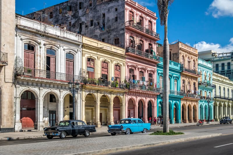
CubaCultural151 km away
CubaCultural340 km away
CubaCultural341 km away
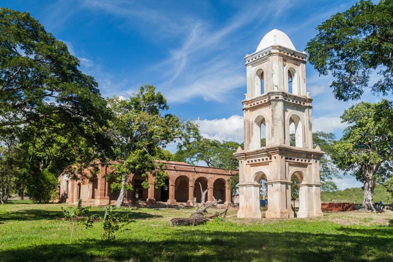
CubaCultural395 km away
United StatesNatural430 km away
18
Further resources
Books, links and people who know the ground
Links
The official record
- World Heritage Centre page for this sitewhc.unesco.org
Trip reports
No one has written up a visit to Viñales Valley yet. If you have been, we would like to hear how it went.
Been here? Share a trip reportGuest reports are credited and edited with you before they appear.
Suggest a correction or additionEvery message is read by an editor.
Last reviewed